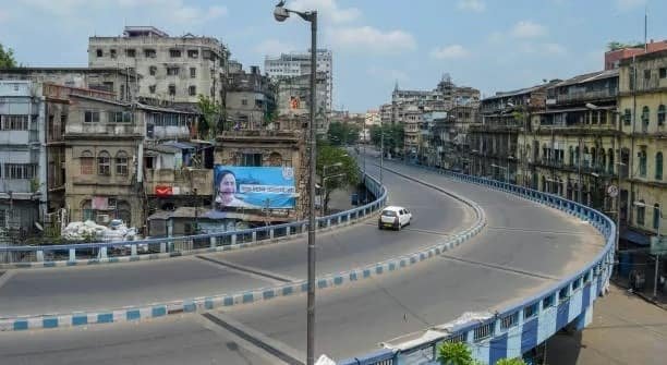
Vakil Saheb Bridge is a major flyover at Bopal Crossroads in western Ahmedabad, developed to improve traffic movement between Bopal-Ghuma and the main Ahmedabad city area. Officially named the Lakshmanrao Inamdar Flyover, the bridge passes through one of the busiest parts of Ahmedabad’s rapidly expanding western suburbs and is closely associated with the Sardar Patel Ring Road and Ambli-Bopal Road corridor.
The approximately 1.4-km-long flyover was inaugurated in July 2017. It was built by the Ahmedabad Urban Development Authority (AUDA) and named after Lakshmanrao Inamdar, popularly known as Vakil Saheb. The opening of the flyover was particularly significant because Bopal Crossroads had become a major bottleneck as residential and commercial development expanded rapidly around Bopal, South Bopal, Ambli and Ghuma.
The bridge continues to play an important role in western Ahmedabad, although increasing traffic around its landing points has created new challenges. A 2026 road-safety audit also identified the Vakil Saheb Bridge area as one of the city’s locations requiring additional traffic-management attention.
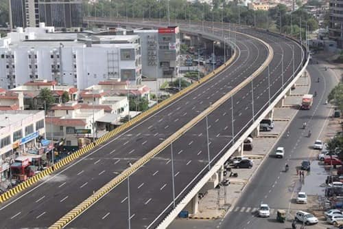
Quick Overview of Vakil Saheb Bridge
| Particular | Details |
| Official Name | Lakshmanrao Inamdar Flyover |
| Common Name | Vakil Saheb Bridge / Bopal Flyover |
| Location | Bopal, Ahmedabad, Gujarat |
| Structure Type | Urban road flyover |
| Approximate Length | 1.4 km |
| Configuration | Six-lane flyover |
| Opened | July 2017 |
| Developed By | Ahmedabad Urban Development Authority |
| Major Road Area | Bopal Crossroads / Sardar Patel Ring Road corridor |
| Important Connecting Road | Ambli-Bopal Road |
| Nearby Areas | Bopal, South Bopal, Ambli, Ghuma, Shela and Shantipura |
| Towards Ahmedabad City | Ambli, Sindhu Bhavan Road, SG Highway and Satellite side |
| Towards Outer West | Bopal, Ghuma and developing western suburbs |
| Known For | Major western Ahmedabad commuter flyover |
| Current Development Focus | Proposed elevated corridor towards Ghuma and sports facilities beneath bridge |
At the time of inauguration, Indian Express reported the structure as a six-lane, 1.4-km flyover built at approximately ₹85 crore.
Where is Vakil Saheb Bridge Located?
Vakil Saheb Bridge is located at Bopal Crossroads in western Ahmedabad, where traffic from the Bopal-Ghuma side meets the wider Sardar Patel Ring Road and Ambli-Bopal road network.
Bopal has developed into one of Ahmedabad’s major residential suburbs, while areas such as South Bopal, Ambli, Shela and Ghuma have seen extensive housing and commercial development. The bridge therefore serves a much larger population today than when planning for the project originally began.
The flyover is particularly useful for motorists travelling between Bopal-Ghuma and the established city areas around Ambli, Satellite, Bodakdev and SG Highway.
Its position close to the Sardar Patel Ring Road also gives motorists access to routes towards Shantipura, Sanathal, Science City, Thaltej and other parts of Ahmedabad’s outer road network.
Vakil Saheb Bridge Route and Road Connectivity
Vakil Saheb Bridge is an important east-west connection through the Bopal area.
Major road connections include:
- Bopal: The principal residential locality associated with the bridge.
- Ghuma: Located farther west and reached by continuing through Bopal.
- Ambli: Important locality towards the city side with connections towards SG Highway.
- South Bopal: Large residential neighbourhood easily accessible from the bridge corridor.
- Shela: Rapidly developing residential area accessible through the wider South Bopal road network.
- Shantipura: Located along the Sardar Patel Ring Road towards the southern side.
- SG Highway: Accessible through Ambli and adjoining western Ahmedabad roads.
- Sindhu Bhavan Road: Major commercial and dining corridor reachable from the Ambli side.
- Satellite: Established residential and commercial area farther towards central Ahmedabad.
Before the flyover was constructed, vehicles travelling between Bopal-Ghuma and Ahmedabad had to negotiate busy surface-level intersections. The elevated road allowed a substantial portion of through traffic to bypass those junction movements. Contemporary reporting specifically described the project as a solution for commuters travelling from Bopal and Ghuma towards Ahmedabad.
Why is Vakil Saheb Bridge Important?
The importance of Vakil Saheb Bridge is closely connected to the enormous growth of western Ahmedabad.
Bopal was once considered a peripheral suburb, but residential development has gradually expanded beyond it towards Ghuma, South Bopal, Shela and adjoining areas. At the same time, Ambli, Sindhu Bhavan Road and the SG Highway belt have developed into major commercial and office destinations.
The bridge sits between these two patterns of development.
During weekday mornings, large numbers of vehicles move from western residential neighbourhoods towards employment and commercial areas closer to the city. In the evening, much of this movement reverses.
The flyover helps separate some through traffic from vehicles using Bopal Crossroads and nearby service roads. Without this grade separation, traffic from several directions would have to compete for space at the surface junction.
Traffic Conditions at Vakil Saheb Bridge
Traffic around Vakil Saheb Bridge can become substantial during morning and evening peak periods, particularly at the entry and exit points.
The bridge itself allows through traffic to avoid part of the surface-level congestion, but bottlenecks can develop where vehicles leave the flyover and merge with local roads.
Traffic pressure is influenced by:
- Office-hour commuting from Bopal and Ghuma
- Rapid residential growth in South Bopal and Shela
- Traffic using Sardar Patel Ring Road
- School and college movement
- Commercial activity around Ambli-Bopal Road
- Vehicles turning into residential societies
- Pedestrian movement near the bridge approaches
Even during its planning stage, officials recognised that solving congestion at Bopal Crossroads could move traffic pressure towards the ends of the new flyover if turning movements were not properly managed.
This remains one of the key issues around the corridor today: the flyover improves through movement, but the surrounding road system must also accommodate rapidly growing local traffic.
Road Safety Around Vakil Saheb Bridge
Unlike many bridges where an accident section would add little value, road safety is particularly relevant at Vakil Saheb Bridge.
A 2026 Gujarat Road Safety Authority audit identified several high-risk locations across Ahmedabad. The Bopal Vakil Saheb Bridge area was among the western suburban locations highlighted, with 14 accidents recorded around the bridge area. The audit pointed to shortcomings in traffic management around newer infrastructure and noted problems where vehicles make risky manoeuvres near the bridge landing.
Authorities have since taken corrective steps at nearby conflict points. An unauthorised road opening around the Andaj Party Lawn junction, which had been used for unsafe vehicle movements, was permanently closed as part of the safety response.
Pedestrian movement also requires care because the bridge area includes the high-speed Sardar Patel Ring Road corridor. A fatal hit-and-run in May 2026 involved a pedestrian crossing the road near the southern end of Vakil Saheb Bridge.
For motorists, the practical concern is therefore not simply speed on the flyover. Attention is especially important around merging lanes, service roads, bridge landings and pedestrian crossing points.
Proposed Vakil Saheb Bridge-Ghuma Elevated Corridor
One of the most significant future proposals for this part of Ahmedabad is an additional elevated corridor between Vakil Saheb Bridge and Ghuma village.
Ahmedabad Municipal Corporation’s draft budget for 2026-27 proposed a 3.5-km elevated corridor from Bopal Vakil Saheb Bridge to Ghuma village. The project forms part of a broader plan to tackle congestion on some of Ahmedabad’s busiest urban routes.
The proposal is particularly relevant because residential development has moved steadily west of Bopal.
As more people live in Ghuma and surrounding neighbourhoods, traffic reaching the western end of Vakil Saheb Bridge continues to increase. Extending grade-separated road infrastructure farther towards Ghuma could help reduce the number of vehicles interacting with surface-level junctions.
However, the corridor remained a proposed project in the 2026-27 budget framework, so its final construction schedule will depend on approvals, design and execution.
Sports Facilities Under Vakil Saheb Bridge
The space underneath Vakil Saheb Bridge is also being considered for a very different purpose.
In June 2026, Ahmedabad Municipal Corporation included the Lakshmanrao Vakil Saheb Bridge among bridges where sports activity centres were being developed or planned. The initiative is intended to make better use of otherwise underutilised spaces beneath flyovers.
The facilities are being developed under a public-private partnership model and are aimed particularly at children and young residents.
This approach is becoming increasingly common in Ahmedabad. Instead of leaving large spaces below elevated roads unused or poorly maintained, the civic body is converting selected sites into areas for recreation and community activity.
For Bopal, such a facility could be particularly useful because of the large young population living in nearby residential societies.
History and Naming of Vakil Saheb Bridge
Construction of the Bopal flyover began around 2014, as traffic problems at the crossroads became increasingly severe. The project took roughly three years to complete.
The bridge opened on July 6, 2017, and was named after Lakshmanrao Inamdar, popularly known as Vakil Saheb. At the inauguration, the structure was officially presented as the Lakshmanrao Inamdar Flyover.
Although the official name remains Lakshmanrao Inamdar Flyover, local residents, businesses and navigation references commonly use Vakil Saheb Bridge, Vakil Saheb Flyover or Bopal Flyover.
The informal name has become so widely established that it is now commonly used as a location reference for nearby shops, offices, hospitals and residential developments.
Public Transport Near Vakil Saheb Bridge
Public transport around Bopal is mainly road based.
City buses serve Bopal and surrounding western Ahmedabad neighbourhoods, while autos and app-based cabs are commonly available along Ambli-Bopal Road and the nearby residential corridors.
Vakil Saheb Bridge itself has also become a recognised pickup and drop-off reference point for some private and intercity bus operators using the Sardar Patel Ring Road corridor. Current travel listings identify Vakil Saheb Flyover near Ambli-Bopal Road as a boarding location.
Ahmedabad Metro does not currently have a station immediately beside Vakil Saheb Bridge. Motorists and public-transport users therefore continue to depend heavily on roads for daily trips between Bopal and other parts of Ahmedabad.
Major Landmarks and Facilities Near Vakil Saheb Bridge
Important landmarks and activity areas around the bridge include:
- Bopal Crossroads: Major junction associated with the flyover.
- Sardar Patel Ring Road: One of Ahmedabad’s most important outer arterial roads.
- Ambli-Bopal Road: Major urban corridor linking Bopal with Ambli and the SG Highway side.
- South Bopal: Large residential neighbourhood close to the bridge.
- Shantipura Circle: Important Ring Road junction towards the south.
- Sindhu Bhavan Road: Major dining, office and commercial destination accessible towards the city side.
- SG Highway: One of western Ahmedabad’s principal commercial corridors.
The wider area has extensive access to hospitals, schools, restaurants, supermarkets, offices, hotels and other everyday facilities.
Nearby Areas to Vakil Saheb Bridge
- Bopal: The main residential locality associated with the bridge and one of western Ahmedabad’s major suburban centres.
- South Bopal: Large residential extension with numerous apartment complexes and commercial developments.
- Ambli: Important locality between Bopal and SG Highway, with strong residential and office development.
- Ghuma: Located west of Bopal and increasingly important because of continued residential expansion.
- Shela: Fast-growing residential area accessible through the South Bopal road network.
- Shantipura: Important Ring Road locality towards the southern side of the bridge corridor.
- Bodakdev: Established western Ahmedabad commercial and residential area accessible through Ambli and SG Highway.
FAQs About Vakil Saheb Bridge Ahmedabad
Q1. Is Vakil Saheb Bridge the same as Bopal Flyover?
Yes. Vakil Saheb Bridge, Bopal Flyover and Lakshmanrao Inamdar Flyover generally refer to the same structure at Bopal Crossroads. Lakshmanrao Inamdar Flyover is its official name.
Q2. Is there a toll for using Vakil Saheb Bridge?
There is no separate toll simply for driving over Vakil Saheb Bridge. It functions as part of Ahmedabad’s urban road network.
Q3. Will the flyover be extended towards Ghuma?
AMC’s 2026-27 draft budget proposed a 3.5-km elevated corridor from Vakil Saheb Bridge to Ghuma village. It is a future infrastructure proposal rather than an operational extension at present.
Q4. Are sports facilities being developed below Vakil Saheb Bridge?
Yes. AMC included Lakshmanrao Vakil Saheb Bridge among locations where sports activity centres are being developed or planned under a PPP model.
Q5. What should motorists be careful about near the bridge?
The bridge landing areas, service roads and nearby turning points deserve particular attention. A 2026 road-safety audit recorded multiple accidents in the Vakil Saheb Bridge area and identified the need for stronger traffic management around the surrounding junctions.