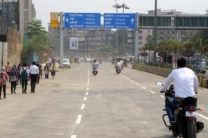
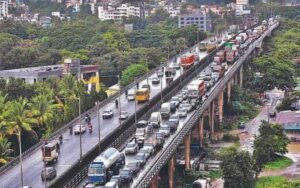
Subhash Bridge is an important road crossing over the Sabarmati River in Ahmedabad, Gujarat. For more than five decades, it served as a major connection between the RTO Circle and Sabarmati-Ranip side in western Ahmedabad and Shahibaug and northern-central parts of the city on the opposite bank. The route was particularly useful for commuters travelling towards the airport, Civil Hospital, Asarwa, Gandhi Ashram and central Ahmedabad.
The original Subhash Bridge was constructed by the Ahmedabad Municipal Corporation (AMC) in 1973. It measured approximately 453.75 metres long and 12.85 metres wide. However, the bridge was closed to vehicles on 4 December 2025 after structural distress was detected. Subsequent technical assessments led AMC to abandon the earlier repair-only plan and move towards complete demolition and reconstruction. By July 2026, demolition of the old structure was underway.
The replacement is planned as a substantially wider eight-lane bridge, making the Subhash Bridge corridor one of Ahmedabad’s significant ongoing road-infrastructure projects.
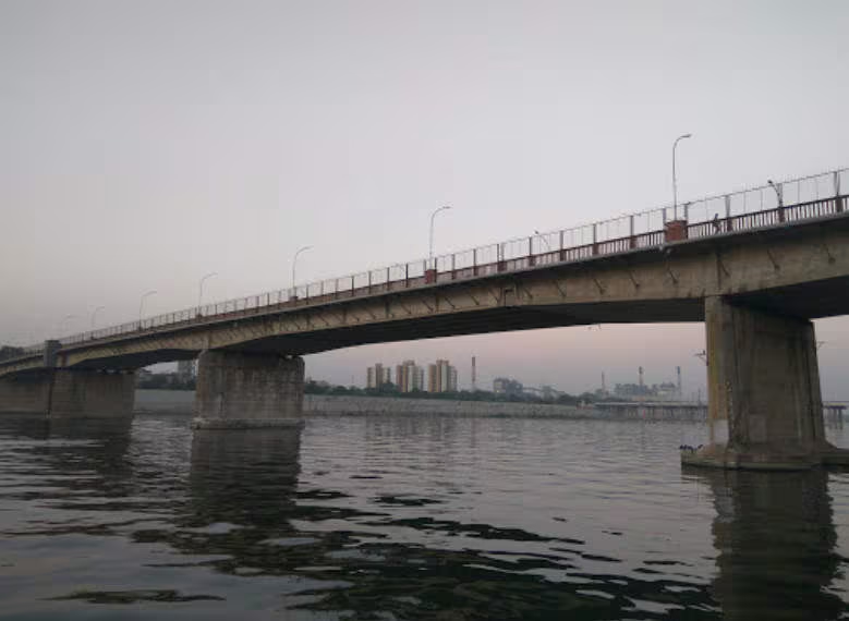
Quick Overview of Subhash Bridge
| Particular | Details |
| Name | Subhash Bridge |
| Location | Ahmedabad, Gujarat |
| River | Sabarmati River |
| Original Bridge Built | 1973 |
| Original Bridge Length | 453.75 metres |
| Original Width | 12.85 metres |
| Major Western Approach | RTO Circle/Subhash Circle |
| Eastern Connection | Shahibaug side |
| Nearby Areas | Sabarmati, Ranip, Shahibaug, Nava Vadaj and Asarwa |
| Important Nearby Landmark | Sabarmati Ashram |
| Current Status | Old bridge closed and being replaced |
| New Bridge Plan | Eight-lane portal-frame bridge |
| Estimated Project Cost | Around ₹241 crore |
| Proposed Construction Period | 24 months |
| Implementing Authority | Ahmedabad Municipal Corporation |
| Known For | Major north Ahmedabad river crossing and RTO Circle connectivity |
The current eight-lane replacement project was reported at approximately ₹241 crore, with a 24-month overall timeline and a target of completing one side in about 16 months.
Where is Subhash Bridge Located?
Subhash Bridge crosses the Sabarmati River in northern Ahmedabad. Its western end is associated with Subhash Circle and RTO Circle, while the eastern side leads towards Shahibaug and the northern-central parts of the city.
The bridge’s position made it particularly useful for motorists travelling between western neighbourhoods such as Ranip, Sabarmati and Nava Vadaj and destinations such as Shahibaug, Asarwa, Civil Hospital and Ahmedabad Airport.
The Subhash Bridge name is also commonly used for the wider neighbourhood around RTO Circle. As a result, hotels, businesses, residential addresses and public facilities in this part of Ahmedabad may use “Subhash Bridge” in their address even when they are not directly beside the physical bridge.
Sabarmati Ashram is another major landmark in the wider corridor, making this part of Ahmedabad important for both everyday commuting and visitors exploring the city’s historic sites.
Subhash Bridge Route and Road Connectivity
Historically, Subhash Bridge provided a direct east-west connection across the Sabarmati in northern Ahmedabad.
From the western side, traffic approached through RTO Circle, with road links towards Sabarmati, Ranip, Nava Vadaj, Chandkheda and Ashram Road. After crossing the river, motorists could continue towards Shahibaug and use connecting roads for Asarwa, Civil Hospital, Delhi Darwaza, the airport and other northern and central parts of Ahmedabad.
Important connections around the corridor include:
- RTO Circle: One of the most important junctions adjoining the western approach.
- Sabarmati: Major residential and transport area north of the bridge.
- Ranip: Accessible from the western approach and 132 Feet Ring Road network.
- Nava Vadaj: Important residential area connected through Vadaj and surrounding roads.
- Shahibaug: Major locality on the eastern side of the Sabarmati.
- Asarwa: Accessible through the Shahibaug road network.
- Ahmedabad Airport: Traditionally accessible from the bridge corridor through Shahibaug and connecting roads.
- Ashram Road: Important north-south arterial road on the western side of the river.
Because the original bridge is currently unavailable, motorists cannot presently use this direct crossing and must follow alternative river crossings and traffic diversions.
Why is Subhash Bridge Important?
Subhash Bridge became important because it connected several densely populated parts of western and northern Ahmedabad with Shahibaug and the city’s eastern road network.
It was especially valuable for commuters from Ranip, Sabarmati and Nava Vadaj travelling towards Shahibaug, Asarwa, Civil Hospital and the airport. The effect of its closure demonstrated how much traffic depended on the crossing: congestion increased notably around RTO Circle, Vadaj Circle and the eastern Sabarmati Riverfront Road after the bridge was shut.
The location is also strategically important because several major north Ahmedabad roads converge around RTO Circle. Rebuilding the crossing with substantially greater capacity is therefore intended not merely to replace an old bridge but to prepare the corridor for higher future traffic volumes.
Traffic Conditions at Subhash Bridge
Subhash Bridge is currently not functioning as a normal road crossing. The original bridge has remained closed to vehicular traffic since December 2025, and demolition work began as plans shifted towards complete reconstruction.
Its closure has changed traffic patterns across northern Ahmedabad. RTO Circle, Vadaj Circle and sections of Sabarmati Riverfront Road have experienced additional traffic because vehicles that previously crossed directly at Subhash Bridge must use other routes.
Important alternatives used during the closure have included:
- Chimanbhai Patel Bridge
- Dadhichi Bridge
- Indira Bridge
- Sabarmati Riverfront roads
- Other local routes through Vadaj, Shahibaug and surrounding junctions
Traffic police have previously advised commuters to allow additional travel time, particularly during weekday morning and evening peaks.
The exact best diversion depends on whether the destination is Shahibaug, Asarwa, the airport, central Ahmedabad or another part of the city.
Subhash Bridge Reconstruction and Eight-Lane Project
The redevelopment of Subhash Bridge has changed significantly since the bridge was first closed.
AMC initially planned to repair the old bridge and build additional two-lane bridges on either side. Detailed investigations, however, later found further structural concerns, including issues involving the bridge’s pillars. Authorities subsequently decided that complete demolition and reconstruction would provide a better long-term solution.
By July 2026, demolition was actively underway, including controlled removal of spans situated in the Sabarmati riverbed.
The latest project plan reported in August 2026 involves constructing a modern eight-lane portal-frame bridge at an estimated cost of around ₹241 crore. The planned overall construction period is 24 months, while AMC is targeting completion of one side within approximately 16 months so that some traffic capacity can potentially become available earlier.
The wider bridge is expected to provide considerably more capacity than the old 12.85-metre-wide structure. Once completed, it should strengthen east-west connectivity while reducing pressure on alternative Sabarmati crossings.
Public Transport Near Subhash Bridge
The Subhash Bridge-RTO Circle area is served by Ahmedabad’s road-based public transport network, including city buses, BRTS connections, auto-rickshaws and app-based cabs.
Metro connectivity has also expanded in northern Ahmedabad. Ahmedabad Metro Phase II includes the Sabarmati Railway Station metro stop on the northward corridor, improving rail-based connectivity in the wider Sabarmati area.
For rail travel, the Sabarmati railway complex is an important nearby transport hub. Ahmedabad Junction at Kalupur remains the city’s principal conventional railway station for many long-distance services.
During bridge reconstruction, bus and cab journeys that would normally use the Subhash Bridge corridor may require diversions, so road travel times can vary considerably during peak hours.
Major Landmarks and Facilities Near Subhash Bridge
Several important places are located in and around the Subhash Bridge corridor:
- Sabarmati Ashram: One of Ahmedabad’s most important historic landmarks on the western bank of the Sabarmati.
- RTO Circle: Major road junction and well-known reference point beside the Subhash Bridge area.
- Sabarmati Railway Station: Important rail hub serving northern Ahmedabad.
- Sabarmati Riverfront: Developed riverfront corridor with roads and public spaces along the river.
- Shahibaug: Major residential and institutional area across the river.
- Civil Hospital Ahmedabad: Major healthcare institution accessible through the Asarwa side.
- Ranip: Large residential locality northwest of the bridge.
- Vadaj: Important western Ahmedabad locality and road junction.
Hotels, restaurants, hospitals, educational institutions, government offices and everyday shopping facilities are widely available throughout the Subhash Bridge, Sabarmati, Shahibaug and Vadaj areas.
Nearby Areas to Subhash Bridge
- Sabarmati: One of the closest major localities and an important railway and residential zone north of the bridge.
- Shahibaug: Located on the opposite side of the Sabarmati and important for access towards Asarwa, the cantonment area and airport routes.
- Ranip: Large residential locality accessible from the RTO Circle side.
- Nava Vadaj: Established residential and commercial area connected through the Vadaj road network.
- Asarwa: Important eastern Ahmedabad locality containing major healthcare and railway facilities.
- Vadaj: Located southwest of the bridge area and connected through major city roads.
FAQs
Q1. Is Subhash Bridge Ahmedabad the same as Atal Bridge?
No. They are different bridges across the Sabarmati River. Subhash Bridge has historically been a road bridge carrying regular city traffic, while Atal Bridge is a 300-metre pedestrian attraction farther south on the Sabarmati Riverfront.
Q2. Why do many Ahmedabad addresses use “Subhash Bridge” as a location?
Over time, Subhash Bridge became a major city landmark and the surrounding RTO Circle area also became popularly identified by the same name. As a result, “Subhash Bridge” appears in the addresses of hotels, businesses and other properties in the surrounding neighbourhood.
Q3. Is Sabarmati Railway Station convenient for the Subhash Bridge area?
Yes. Sabarmati is one of the main railway areas serving this part of northern Ahmedabad, and Ahmedabad Metro’s expanded network also includes Sabarmati Railway Station on its northern corridor.
Q4. Can the Subhash Bridge corridor be used for travelling towards Ahmedabad Airport?
The corridor historically provided a useful connection towards Shahibaug and onward airport roads. During the present bridge reconstruction, however, motorists need to use alternative crossings and diversions instead of the old Subhash Bridge.