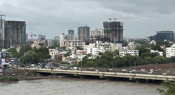
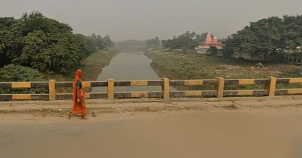
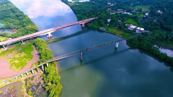
Koottupuzha Bridge is an important inter-state road bridge at the Kerala-Karnataka border in Kannur district. Located near Koottupuzha in Ayyankunnu panchayat, the bridge carries the Thalassery-Iritty-Virajpet road across the Koottupuzha River and forms one of the principal road gateways between north Kerala and Kodagu district in Karnataka. Kerala Tourism places Koottupuzha around 12 km from Iritty on the Virajpet route.
The present bridge opened to traffic on 31 January 2022. It replaced the practical dependence on an old and extremely narrow crossing that was no longer suitable for present-day traffic volumes. The new bridge is particularly useful for travellers between Kannur and Virajpet, Madikeri and Mysuru, as well as people travelling between Kannur International Airport and Kodagu.

Koottupuzha itself is a small border locality, but its position gives the bridge considerable regional importance. On the Kerala side, the route runs towards Iritty and Vallithode. After the state boundary, it continues through the Makkootam-Perumbadi ghat section towards Virajpet.
Quick Overview of Koottupuzha Bridge
| Particular | Details |
| Name | Koottupuzha Bridge / Kootupuzha Bridge |
| Location | Koottupuzha, Kannur district, Kerala-Karnataka border |
| River | Koottupuzha River |
| Structure Type | Road bridge |
| Opened | 31 January 2022 |
| Length | 84 metres |
| Width | 12 metres |
| Spans | Five spans |
| Main Road | Thalassery-Iritty-Virajpet inter-state road / Kerala SH 30 approach |
| Project | Thalassery-Valavupara KSTP road improvement project |
| Main Connection | Kannur-Iritty side with Kodagu district, Karnataka |
| Nearby Kerala Town | Iritty |
| Karnataka Direction | Makkootam-Perumbadi-Virajpet |
| Public Transport | Local and inter-state buses, taxis and private vehicles |
| Current Role | Active Kerala-Karnataka border road crossing |
The completed bridge has four 18-metre spans and one 12-metre span, giving a total length of 84 metres. Its reported width is 12 metres.
Where is Koottupuzha Bridge Located?
Koottupuzha Bridge is located at the eastern edge of Kannur district, close to the Kerala-Karnataka state boundary. Koottupuzha lies about 12 km from Iritty on the road towards Virajpet.
The bridge stands in a hilly, forest-edge landscape rather than an urban setting. Ayyankunnu is the Kerala-side panchayat, while the road enters the Makkootam-Brahmagiri forest belt after crossing towards Karnataka.
This position makes Koottupuzha Bridge a natural gateway for road journeys from Thalassery, Kannur and Iritty towards Kodagu.
Koottupuzha Bridge Route and Road Connectivity
The bridge lies on the long-established Thalassery-Coorg-Mysuru road corridor. Kerala SH 30 runs from Thalassery towards the Karnataka border at Koottupuzha.
- Iritty: Main Kerala town west of the bridge and the most useful nearby transport centre.
- Vallithode: Important junction on the approach between Iritty and Koottupuzha.
- Thalassery: Western starting point of Kerala SH 30 and an important coastal connection.
- Kannur and Kannur International Airport: Reached through the Iritty-Mattanur road network.
- Makkootam: Forest-border section immediately after entering Karnataka.
- Virajpet: Principal Kodagu town reached through the Makkootam-Perumbadi ghat road.
- Madikeri: Reached onward from Virajpet through the Kodagu road network.
- Mysuru: Common longer-distance destination through the Virajpet-Gonikoppal-Hunsur side.
Why is Koottupuzha Bridge Important?
Koottupuzha Bridge is important because it forms part of one of the established road links between north Kerala and Kodagu.
Kerala PWD’s KSTP documentation noted that thousands of vehicles used the road and that the earlier Koottupuzha bridge was too narrow for increasing traffic. According to the project justification, even two light motor vehicles could not comfortably cross the old bridge together.
The corridor is also important for access between Kannur International Airport and Kodagu. During planning for the replacement bridge, Kerala authorities specifically highlighted the route’s importance for Virajpet, Madikeri and other parts of Karnataka.
Traffic Conditions at Koottupuzha Bridge
Traffic across Koottupuzha Bridge includes cars, two-wheelers, buses, tourist vehicles and goods traffic travelling between Kerala and Karnataka. The new bridge is substantially wider than the previous crossing and allows normal two-way movement.
However, the condition of the wider journey depends heavily on the Makkootam-Perumbadi ghat road after entering Karnataka. The route has steep and winding forest sections where rain and poor road surfaces can slow traffic.
This remains relevant in 2026. A July 2026 report said portions of the recently renovated Makkootam-Perumbadi route had deteriorated again, including sections on the Koottupuzha-Makkootam side.
Drivers heading towards Virajpet should therefore consider conditions on the complete ghat road rather than judging the journey only by traffic at the bridge.
Bridge Design and Dimensions
The present Koottupuzha Bridge is approximately 84 metres long and 12 metres wide.
It consists of:
- Four spans of 18 metres each
- One span of 12 metres
- Pedestrian space
- Road markings and road studs
- Traffic signboards
- Solar street lighting
- Approach roads on both sides
These features represented a major improvement over the narrow older bridge.
History and Construction of Koottupuzha Bridge
The new bridge was developed as part of the Thalassery-Valavupara road improvement project under the Kerala State Transport Project.
Construction began in 2017, but the project encountered an unusual problem at the interstate border. Karnataka forest authorities objected to work where the far-side approach entered land under their forest jurisdiction near the Brahmagiri wildlife area. Construction on part of the bridge consequently stopped for several years.
The required Karnataka-side forest diversion covered only a small area. The Union environment ministry granted in-principle approval in August 2020 for diversion of around 0.177 hectare of forest land in Heggola village, Virajpet taluk, specifically for the Koottupuzha Bridge project.
Work resumed after the clearance process and the bridge was completed in December 2021. An initially planned New Year opening was postponed, and the bridge finally opened to traffic on 31 January 2022.
Old and New Koottupuzha Bridges
The old Koottupuzha bridge carried interstate traffic for decades. Kerala PWD project records describe it as a bridge dating from the 1930s and emphasise how narrow it had become for modern traffic.
The replacement bridge was constructed close to the existing crossing specifically to remove this bottleneck.
Today, when travellers refer to Koottupuzha Bridge for normal road travel, they generally mean the wider bridge opened in 2022. The older bridge remains a visible part of the area’s transport history.
Koottupuzha Bridge and the Kerala-Karnataka Border
The state boundary played a major role in the bridge’s unusually long construction history.
During construction, Karnataka authorities argued that land beyond the river belonged to their forest jurisdiction. The issue led to surveys, forest-clearance applications and coordination between Kerala, Karnataka and central authorities.
Although the bridge itself is relatively short, it therefore has significance beyond its dimensions. It forms a physical interstate connection between Kannur district and Kodagu.
Koottupuzha River and Barapole
The bridge crosses the waterway commonly referred to locally and in project reporting as the Koottupuzha River. Kerala forest basin records list Koottupuzha within the Valapattanam river system.
The broader Koottupuzha-Ayyankunnu area is also closely associated with the Barapole River. Kerala Revenue Department records locate the Barapole Small Hydro Electric Project near Koottupuzha in Ayyankunnu.
River flow can increase substantially during strong monsoon periods because the catchment extends towards the forested highlands of Karnataka.
Public Transport Near Koottupuzha Bridge
Private and public buses operate on the wider Thalassery-Iritty-Koottupuzha corridor.
Kerala Motor Vehicles Department route records include stage-carriage services between Thalassery and Koottupuzha via Kuthuparamba, Mattannur and Iritty.
Autos and taxis are easier to find at Iritty and other larger settlements than immediately at the state-border bridge. Travellers continuing towards Virajpet should check current bus timings because service frequencies may vary.
Kannur International Airport is the most convenient major airport for much of the Kerala side of this corridor.
Major Landmarks and Places Near Koottupuzha Bridge
- Koottupuzha border area: Small settlement and transport reference point around the bridge.
- Barapole river landscape: Scenic river and forest-edge environment in eastern Kannur.
- Makkootam forest stretch: Hilly Karnataka-side road section immediately beyond the border.
- Ayyankunnu: Border panchayat on the Kerala side.
- Barapole Small Hydro Electric Project area: Hydropower project located near Koottupuzha.
- Iritty: Main nearby Kerala town and transport hub.
Nearby Areas to Koottupuzha Bridge
- Koottupuzha: Border locality directly associated with the bridge.
- Ayyankunnu: Kerala-side panchayat surrounding the border area.
- Vallithode: Important road junction towards Iritty.
- Iritty: Main nearby Kerala town.
- Makkootam: Karnataka-side forest and ghat-road locality.
- Perumbadi: Important point on the road towards Virajpet.
- Virajpet: Major Kodagu town connected through the interstate route.
FAQs About Koottupuzha Bridge Kannur
Q. Is there a toll at Koottupuzha Bridge?
There is no dedicated toll plaza on the bridge itself. It operates as part of the regular interstate road between Kerala and Karnataka.
Q. Is the Koottupuzha-Virajpet route suitable during the monsoon?
The bridge itself is an established road crossing, but the Makkootam-Perumbadi ghat section can become difficult during heavy rain. Road damage was again reported on parts of this route in July 2026, so checking current road and weather conditions is sensible before a monsoon trip.
Q. Are there border checks near Koottupuzha Bridge?
Koottupuzha is an interstate border route, and enforcement or excise checks can operate around the border area. Travellers should carry the normal vehicle and personal documents required for interstate travel.
Q. Is Koottupuzha a practical route from Kannur to Kodagu?
Yes. The Iritty-Koottupuzha-Makkootam route is an established approach from Kannur district towards Virajpet and other parts of Kodagu. The actual journey time can vary considerably according to ghat-road, rainfall and traffic conditions.