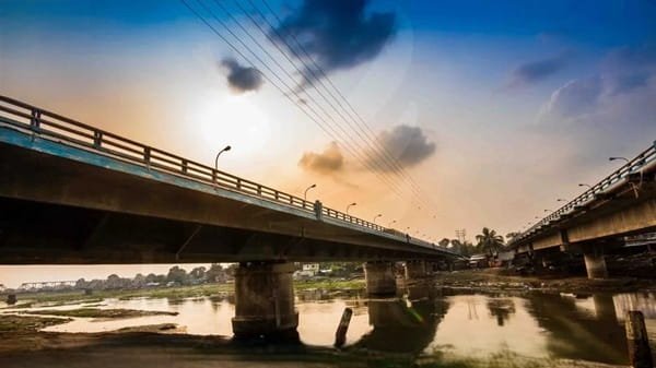
Perumbalam Bridge is a major new road bridge across the Vembanad backwaters in Alappuzha district, Kerala. Opened on 7 March 2026, it gives Perumbalam Island its first permanent road connection to the mainland, linking the island with the Arookutty-Panavally side of the Aroor constituency.
The bridge is about 1.155 km long and 11 metres wide. Its most recognisable feature is a group of three 55-metre bowstring arch spans positioned over the navigation channel, while the rest of the crossing uses 27 conventional spans of 35 metres each. The design keeps water traffic moving below while providing a two-lane road and pedestrian walkways above.

For Perumbalam residents, the bridge represents a major change in everyday life. Until 2026, the island depended heavily on boats and ferry services for access to the mainland. Cars, two-wheelers and autorickshaws can now travel directly across the bridge, improving access to schools, hospitals, markets and workplaces. The bridge has also created new tourism potential for the quiet island landscape.
Quick Overview of Perumbalam Bridge
| Particular | Details |
| Name | Perumbalam Bridge / Perumbalam-Panavally Bridge |
| Location | Perumbalam Island, Alappuzha district, Kerala |
| Crosses | Vembanad backwaters |
| Connects | Perumbalam Island with the Arookutty-Panavally mainland side |
| Approximate Length | 1,155.40 metres |
| Width | 11 metres |
| Carriageway | 7.5 metres, two-lane road |
| Pedestrian Walkways | 1.5 metres on both sides |
| Standard Spans | 27 spans of 35 metres each |
| Navigation Spans | Three bowstring arch spans of 55 metres each |
| Opened | 7 March 2026 |
| Project Cost | About Rs 100-106 crore in published reports |
| Funding | KIIFB |
| Executing Agency | Kerala Road Fund Board under PWD |
| Current Status | Operational |
| Known For | First permanent road link to Perumbalam Island and Kerala’s longest bridge built over a backwater stretch |
Where is Perumbalam Bridge Located?
Perumbalam Bridge is located in the northern part of Alappuzha district and links Perumbalam Island with the mainland in Arookutty panchayat. The mainland approach is associated with the Panavally-Vaduthala side, which is why the structure is also widely called the Perumbalam-Panavally Bridge.
Perumbalam itself is a roughly 6 sq km island in Vembanad Lake. Kerala Tourism describes it as a traditional backwater village where fishing, coir-related work, farming and other water-linked livelihoods have long shaped local life.
The bridge places the island within direct driving reach of Arookutty, Poochakkal, Cherthala and the southern Kochi region. This is especially important because the island lies geographically close to Ernakulam district even though it is administratively part of Alappuzha.
Perumbalam Bridge Route and Road Connectivity
The new bridge creates a direct road route from the island to the mainland. Once vehicles leave the bridge on the Arookutty side, they can join roads towards Poochakkal, Aroor, Cherthala and Kochi.
- Arookutty: Main mainland-side panchayat connected by the bridge.
- Panavally and Vaduthala: Mainland localities associated with the approach to the bridge.
- Poochakkal: Important nearby commercial and road junction south of Arookutty.
- Aroor: Major NH-66 junction connecting the area with Kochi and Alappuzha.
- Cherthala: Important town and railway/bus hub for the northern Alappuzha region.
- Kochi: Reached through Arookutty-Aroor or other connecting mainland roads.
- Perumbalam Island villages: Internal island roads distribute traffic from the bridge towards homes, schools, markets and ferry jetties.
Why is Perumbalam Bridge Important?
The bridge is important because it ended Perumbalam Island’s long dependence on water transport for routine mainland access. Around 12,000 residents were reported to benefit from the new road connection when the bridge opened in March 2026.
Before the bridge, residents relied on ferries and boats for many daily journeys. The new route now allows private cars, two-wheelers and autorickshaws to enter and leave the island directly. This can make emergency travel, school trips, shopping and access to hospitals far easier.
The bridge also supports economic activity. Goods can be moved by road without first being transferred to boats, and tourism businesses can market Perumbalam as a drive-accessible backwater destination rather than an island reached only by ferry.
Traffic Conditions at Perumbalam Bridge
Because the bridge opened only in March 2026, traffic patterns are still developing. The central bridge itself provides a two-lane carriageway, but the more important limitation is the road network inside Perumbalam Island.
A July 2026 report noted that Perumbalam has 37 internal roads and that many of them remain narrow village roads. Vehicle ownership and autorickshaw use increased after the bridge opened, making road widening and traffic management inside the island an important next step.
For visitors, this means the bridge may feel spacious while the roads beyond it can become narrow, especially near homes, junctions and local institutions. Drivers should avoid speeding and should be prepared to share smaller roads with pedestrians, two-wheelers and local traffic.
Engineering and Design of Perumbalam Bridge
The bridge is approximately 1,155.40 metres long and 11 metres wide. It carries a 7.5-metre two-lane carriageway and has 1.5-metre pedestrian paths on both sides.
Its structure includes 27 regular spans of 35 metres each and three central bowstring arch spans of 55 metres each. The longer arch spans were introduced over the navigation channel so that larger fishing and other boats can continue moving through the backwaters without obstruction.
The three prominent arch sections are painted in multiple colours, leading to the local nickname “Rainbow Bridge”. Their visual appearance has turned what was designed as essential transport infrastructure into a new sightseeing landmark.
Construction, Cost and Project Background
The bridge was a long-standing demand of Perumbalam residents. The project was included in Kerala’s 2016-17 budget and received financial assistance from the Kerala Infrastructure Investment Fund Board. Construction work was formally launched in 2019.
Published inauguration reports place the final project cost at around Rs 100-106 crore. The Kerala Road Fund Board division under the Public Works Department handled project execution.
Construction took several years because of legal and technical delays, as well as the challenges of building across a broad backwater channel. The completed bridge was inaugurated by Chief Minister Pinarayi Vijayan on 7 March 2026.
How the Bridge Changed Ferry Travel
Ferries remain part of Perumbalam’s transport system, but their role changed immediately after the bridge opened. The State Water Transport Department’s Perumbalam-Panavally ferry revenue reportedly fell sharply as more residents began using the road bridge.
By July 2026, the Panavally ferry station was still operating dozens of daily trips across several routes, including Perumbalam Market-Panavally and other local services. This is useful because the bridge connects only one end of the island, while ferries can still provide convenient links to different waterfront points.
Local representatives have therefore suggested retaining and repositioning ferry services for tourism rather than allowing them to disappear. A sightseeing network around Perumbalam’s jetties could complement the road bridge and preserve the island’s traditional water-transport character.
Public Transport Near Perumbalam Bridge
A KSRTC bus was ceremonially introduced to Perumbalam at the bridge inauguration in March 2026. However, the public-transport picture remained incomplete later in the year.
By July 2026, local reporting said regular bus services were still expected in the near future and that wider internal roads were needed before bus movement could become practical across more of the island. Autos had meanwhile become an important local transport option after the bridge opened.
For longer journeys, Cherthala remains a major railway and bus hub. Aroor provides access to NH-66 and regular services towards Kochi and Alappuzha, while ferries continue to operate from the Perumbalam and Panavally side.
Tourism Potential of Perumbalam Bridge and Island
The bridge has created a new tourism gateway to Perumbalam. Kerala Tourism describes the island as a quiet backwater village with traditional livelihoods including fishing, cattle rearing, coir work, clam and shell collection, and small-scale farming.
The new bridge makes it easier for day visitors to explore the island by road. Its long water crossing, colourful arches and views across Vembanad also make the bridge itself a visual attraction.
Tourism development is likely to work best if it remains compatible with the island’s narrow roads, residential character and backwater environment. The existing ferry system could also become part of future sightseeing circuits rather than being treated simply as a transport service made obsolete by the bridge.
Major Landmarks and Facilities Near Perumbalam Bridge
Vembanad Lake: The large backwater system crossed by the bridge.
Perumbalam Island: Traditional island village now connected directly by road.
Panavally Ferry Station: Long-standing water-transport point serving Perumbalam and nearby routes.
Arookutty: Main mainland-side panchayat and access area.
Poochakkal: Nearby town with shops, services and road connections.
Aroor: Important NH-66 junction for travel towards Kochi or Alappuzha.
Cherthala: Major regional town with railway and bus connectivity.
Nearby Areas to Perumbalam Bridge
Perumbalam: The island village directly served by the bridge.
Arookutty: Mainland-side locality that provides onward road access.
Panavally: Nearby village associated with the traditional ferry and bridge route.
Poochakkal: Local commercial centre south of the bridge approach.
Aroor: Major highway junction connecting northern Alappuzha with Kochi.
Cherthala: Important town and transport centre farther south.
FAQs About Perumbalam Bridge Alappuzha
Q. Is Perumbalam Bridge open to normal vehicles?
Yes. The bridge has been open to road traffic since 7 March 2026. Cars, two-wheelers and autorickshaws can use it, although roads within Perumbalam Island can be considerably narrower than the bridge itself.
Q. Do ferry services still operate after the bridge opened?
Yes. Ferry services have continued, although passenger numbers and revenue fell after the road bridge opened. They remain useful for reaching different waterfront points around Perumbalam and neighbouring areas.
Q. Has regular KSRTC bus service started across the bridge?
A KSRTC bus was launched during the inauguration, but a July 2026 report said regular bus services were still expected in the near future. Internal road width on the island remains one of the practical constraints.
Q. Why are there three large arches in the middle of the bridge?
The three 55-metre bowstring arch spans provide a wider, unobstructed navigation channel so boats can continue using the Vembanad backwaters below the bridge.
Q. Can pedestrians walk across Perumbalam Bridge?
Yes. The bridge has 1.5-metre pedestrian walkways on both sides of the carriageway. Visitors should use these paths and avoid walking in the traffic lanes.
Q. Is Perumbalam Bridge a good sightseeing stop?
Yes. The colourful arches and wide Vembanad views make it attractive for a short visit, but it remains a working road bridge serving island residents, so visitors should avoid obstructing traffic or local access.