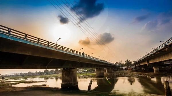
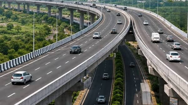
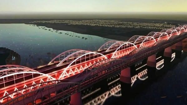
Hanging Bridge Kota, also known as the Kota Chambal Bridge or Kota Bypass Bridge, is one of Rajasthan’s most distinctive highway structures. The six-lane cable-stayed bridge crosses the Chambal River on the Kota Bypass and forms part of NH-27 and the East-West Corridor. It was dedicated to the nation in August 2017 after a long and difficult construction period.
The bridge is about 1.4 km long and 30 metres wide, with 1.5-metre footpaths on both sides. Its cable-supported section was designed to reduce the need for piers in the sensitive Chambal river environment. The bridge therefore combines a major transport function with special engineering measures intended to reduce disturbance to aquatic wildlife.
For road users, its biggest contribution is that it allows long-distance and heavy traffic to bypass central Kota. Vehicles moving across Rajasthan on the Porbandar-Silchar East-West Corridor can cross the Chambal without entering the more congested city road network. At the same time, its tall pylons, fan-like stay cables and dramatic river setting have made it a visual landmark of Kota.

Quick Overview of Hanging Bridge Kota
| Particular | Details |
| Official/Common Name | Kota Hanging Bridge / Kota Chambal Bridge / Kota Bypass Bridge |
| Location | Kota Bypass, Kota, Rajasthan |
| River | Chambal River |
| Highway | NH-27; East-West Corridor |
| Bridge Type | Single-plane cable-stayed road bridge |
| Length | About 1.4 km |
| Width | About 30 metres |
| Traffic Lanes | Six lanes |
| Footpaths | About 1.5 metres wide on both sides |
| Main Cable-Stayed Span | About 350.5 metres |
| Opened | 29 August 2017 |
| Maintaining Authority | National Highways Authority of India (NHAI) |
| Main Role | Kota bypass and long-distance highway connectivity |
| Known For | Cable-stayed design, Chambal gorge views and wildlife-sensitive engineering |
Where is Hanging Bridge Kota Located?
Hanging Bridge Kota is located on the outskirts of Kota city, where the Kota Bypass crosses the Chambal River. It is not the same as the older city bridges near Nayapura, Kota Barrage or the Chambal Riverfront. The hanging bridge belongs to the national-highway bypass corridor and is designed mainly for through traffic.
The crossing sits on NH-27, the modern highway number used for this section of the East-West Corridor. Older documents often refer to the route as NH-76 because the highway numbering system was changed later. Both references can therefore appear in older reports about the bridge.
Its bypass location is important for travellers heading across southeastern Rajasthan. Instead of entering central Kota, long-distance vehicles can remain on the national highway and continue towards the Baran side in one direction and the Bundi-Chittorgarh side in the other.
Hanging Bridge Kota Route and Road Connectivity
The bridge is a key part of the national east-west highway route through Kota. Its broad role can be understood through the following movement pattern:
Bundi/Chittorgarh side -> Kota Bypass -> Hanging Bridge -> Baran side -> onward NH-27 corridor
- NH-27: Main national-highway corridor carrying the bridge.
- Kota Bypass: Direct route for through traffic avoiding central Kota.
- Baran direction: Eastward connection on the East-West Corridor.
- Bundi and Chittorgarh side: Westward highway connections from the bypass.
- NH-52 connections: Useful for traffic moving towards Jhalawar and other southeastern Rajasthan routes.
- Kota city: Accessible from the bypass through connecting urban roads.
Why is Hanging Bridge Kota Important?
Before the bypass bridge became operational, a large amount of intercity and freight traffic had to pass through Kota’s urban road system. That created congestion and increased pressure on city roads. The new Chambal crossing gave through vehicles a direct route around the city.
The bridge also helped complete a missing link in the East-West Corridor, which connects Porbandar in Gujarat with Silchar in Assam. This gives the structure importance far beyond Kota itself. Trucks, buses and private vehicles using the national corridor benefit from a more direct and uninterrupted route.
Its second major importance is environmental. The Chambal is an ecologically sensitive river system. The cable-stayed section reduced the need for multiple supports in the river channel, helping minimise physical disturbance within the sanctuary environment.
Traffic Conditions at Hanging Bridge Kota
Hanging Bridge Kota carries highway traffic rather than mainly local neighbourhood traffic. A large share of its vehicles are intercity cars, buses, trucks and other commercial vehicles using the Kota Bypass.
Because the bridge has six lanes, normal through movement is designed to remain comparatively free-flowing. Delays are more likely to be caused by congestion on the bypass approaches, incidents, road maintenance, toll-related slowing on the wider corridor or unusual weather conditions than by the bridge deck itself.
The bridge should also be treated as an active high-speed highway structure rather than a roadside sightseeing platform. Its views attract photographers, but stopping a vehicle on a live carriageway for photographs can create a serious hazard.
Engineering and Cable-Stayed Design
Despite its popular name, Hanging Bridge Kota is technically a cable-stayed bridge rather than a traditional suspension bridge. In a cable-stayed structure, the deck is supported directly by inclined stay cables connected to tall pylons.
The bridge uses a single-plane arrangement of stay cables. Engineering project information records a main span of about 350.5 metres, with large side spans supported by the cable system. The overall bridge is about 30 metres wide and carries three traffic lanes in each direction.
The stay cables use individually protected strands designed for durability under changing weather and traffic loads. The bridge also incorporates monitoring and safety systems intended to detect events such as severe storms, unusual structural behaviour and earthquakes and communicate information to the bridge control system.
Wildlife-Friendly Design Over the Chambal
One of the most distinctive aspects of the project is the way its engineering was influenced by the Chambal river environment. The river corridor supports important aquatic species, including gharial and other protected wildlife.
To reduce disturbance, roughly 700 metres of the main crossing was developed as a cable-supported section rather than filling the sanctuary stretch with conventional river piers. This is one reason the bridge became widely known as the Hanging Bridge.
Noise-control measures were also incorporated along the sensitive stretch. These features make the Kota bridge a useful example of highway engineering being adapted to environmental constraints rather than treating the river only as an obstacle to be crossed.
Construction Collapse and Safety Lessons
The bridge’s construction history includes a major tragedy and should not be omitted from a complete account of the project. On 24 December 2009, a portion of the under-construction bridge collapsed into the Chambal River. Around 48 workers and engineers were ultimately reported killed in the disaster.
Construction was halted for several years after the collapse. Work resumed later, and the project was eventually completed and opened in 2017. The long delay explains why a project that began in 2006 took more than a decade to reach operation.
The present operational bridge should not be described as accident-prone simply because of the 2009 construction failure. The tragedy occurred while the structure was being built. However, it remains central to the bridge’s history and underlines the importance of design review, construction supervision and structural monitoring on major infrastructure projects.
Hanging Bridge and Kota Bypass
The bridge cannot be understood separately from the Kota Bypass. The bypass was created to move national-highway traffic around the city rather than through dense urban streets. The Chambal crossing was one of the most difficult and expensive pieces required to make that route continuous.
Its opening allowed vehicles travelling between the NH-52 side towards Jhalawar and the NH-27 side towards Baran to avoid more of central Kota. For freight operators, this reduced conflict with local city traffic and provided a more predictable long-distance route.
The bypass role is also why travellers may encounter the name ‘Kota Bypass Bridge’ in engineering and highway references even though residents and tourists usually call it Hanging Bridge.
Public Transport Near Hanging Bridge Kota
The bridge is primarily a national-highway facility, so it does not function like a city bus interchange. Long-distance buses and private coaches may use the bypass depending on their route, while taxis and private vehicles are the most practical options for reaching the bridge area specifically.
Kota Junction is the city’s main railway station and provides extensive train connectivity with Delhi, Mumbai, Jaipur, Ahmedabad and other major cities. Travellers arriving by rail can continue towards the bypass by taxi, auto-rickshaw or other road transport.
Nayapura is an important bus-transport area within Kota, but visitors should remember that the Hanging Bridge lies on the bypass outside the central bus and market districts.
Major Landmarks and Places Near Hanging Bridge Kota
- Chambal River: The major natural feature crossed by the bridge.
- National Chambal Sanctuary river environment: Sensitive habitat that influenced the bridge design.
- Kota city: Main urban centre served by the bypass.
- Chambal Riverfront: Separate city attraction on the river; it should not be confused with the Hanging Bridge location.
- Kota Barrage: Major water-control structure and road crossing closer to the city.
- Garadia Mahadev: Well-known Chambal gorge viewpoint in the wider Kota region.
- Kota Junction: Main railway station for visitors arriving in the city.
Nearby Areas to Hanging Bridge Kota
- Kota city: The principal urban centre associated with the bridge.
- Kunhadi/Kunadi: Developed northern Kota area connected with the broader Chambal-side road network.
- Nayapura: Central transport and commercial area around the older city crossings.
- Nanta: Locality on the north-western side of Kota and part of the wider Chambal road environment.
- Bundi: Important city west of Kota connected through the highway network.
- Baran: Important district centre east of Kota on the NH-27 corridor.
FAQs About Hanging Bridge Kota
Q1. Is Hanging Bridge Kota really a suspension bridge?
No. The popular name can be misleading. Structurally, it is a cable-stayed bridge in which inclined stay cables run directly from the pylons to the deck.
Q2. Can tourists stop their cars on the bridge for photographs?
The bridge is an active six-lane national-highway crossing. Stopping on the carriageway for photographs is unsafe and can obstruct fast-moving traffic. Wider views should be taken only from a lawful and safe location away from live traffic.
Q3. Is Hanging Bridge Kota the same as Kota Barrage bridge?
No. Kota Barrage is a separate water-control structure and road crossing closer to the city. The Hanging Bridge is on the Kota Bypass and carries NH-27 across the Chambal.
Q4. Why was part of the bridge built without normal river piers?
The Chambal is an ecologically sensitive river. The long cable-stayed section helped reduce the number of supports required in the protected river environment and limit disturbance to aquatic wildlife.
Q5. Can pedestrians cross Hanging Bridge Kota?
The bridge was built with footpaths on both sides, but it is primarily a high-speed highway structure. Anyone using pedestrian space should follow current highway rules and avoid treating the bridge as a casual viewing promenade.
Q6. Is there a separate entry ticket to see Hanging Bridge Kota?
No tourist entry ticket is required simply because it is a public highway bridge. Normal highway or toll rules on the wider route may still apply to vehicles depending on the journey.