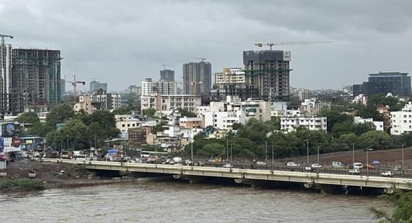
Gorai Bridge is a local road bridge and well-known transport landmark in Borivali West, Mumbai. The existing structure is about 100 metres long and crosses an inlet of the Poisar River in the Gorai area. It provides direct access between the Lower and Upper Koliwada belts, where traditional Koli and gaothan communities live.
The bridge is very different from Mumbai’s large sea links or creek crossings. Its importance comes from everyday neighbourhood connectivity. For residents, emergency vehicles and local traffic, it shortens access to the main road and avoids a longer coastal detour. The name ‘Gorai Bridge’ is also widely used for the surrounding Gorai Link Road bus stop and locality in Borivali West.
The bridge has become an important infrastructure issue because it is more than three decades old. A BMC structural audit found it to be in a dilapidated and unsafe condition, after which the civic body proposed demolition and reconstruction. BMC received Coastal Regulation Zone clearance for the replacement project in 2025 and announced an estimated cost of about Rs 4 crore.
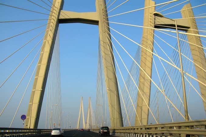
Quick Overview of Gorai Bridge
| Particular | Details |
| Name | Gorai Bridge |
| Location | Gorai, Borivali West, Mumbai, Maharashtra |
| Waterbody | Inlet of the Poisar River |
| Approx. Length | About 100 metres |
| Bridge Type | Local urban road bridge |
| Age | More than 30 years |
| Main Role | Local access between Lower and Upper Koliwada areas |
| Major Road Reference | Gorai Link Road / Borivali West road network |
| Condition | Declared structurally unsafe/dilapidated after civic audit |
| Reconstruction Plan | Demolition and replacement proposed by BMC |
| Estimated Reconstruction Cost | About Rs 4 crore |
| CRZ Clearance | Received in 2025 |
| Public Transport | BEST buses, autos, taxis and Metro access |
| Nearest Practical Metro | Kandivali (West), Metro Line 2A |
| Known For | Local Koliwada access and Gorai transport landmark |
Where is Gorai Bridge Located?
Gorai Bridge is located in Borivali West in Mumbai’s western suburbs. Public-transport listings place the Gorai Bridge stop on Gorai Link Road, close to residential areas such as Gorai 1, Gorai 2 and the wider MHB Colony belt.
The physical bridge passes over an inlet of the Poisar River and serves the Lower and Upper Koliwada areas. These are traditional residential belts associated with Mumbai’s Koli and gaothan communities. The location is therefore more residential and community-oriented than a major highway bridge.
This distinction is important because another, much larger Borivali-Gorai creek bridge has been proposed separately to connect mainland Borivali with Gorai village. The existing Gorai Bridge covered here is not that proposed creek-crossing project.
Gorai Bridge Route and Road Connectivity
The bridge works within the Borivali West-Gorai local road network rather than as an intercity route. Gorai Link Road and connecting roads provide onward access towards Borivali station, Kandivali West, Charkop and Gorai Khadi.
Important road and locality connections include:
- Borivali West: Main suburban commercial and railway hub east of the Gorai area.
- Gorai 1 and Gorai 2: Residential neighbourhoods immediately associated with the bridge locality.
- Gorai Link Road: Important local road and public-transport corridor around the bridge.
- Kandivali West: Major adjoining suburb connected through the western road network.
- Charkop: Large residential locality south of Gorai with road links towards Kandivali.
- Gorai Khadi: Ferry point used for travel towards Gorai village and nearby attractions.
- Borivali Railway Station: Major Western Line station serving the area.
Why is Gorai Bridge Important?
Gorai Bridge is important mainly because it provides short, direct access for local communities. BMC reporting on the reconstruction proposal described it as the only direct access link serving the Lower and Upper Koliwada belts.
For residents, the bridge is particularly important for ambulances, fire engines, school travel, daily commuting and access to markets and public transport. Without the bridge, residents may have to use a longer beach-side route that is more vulnerable during high tide.
The bridge also functions as a local orientation point. ‘Gorai Bridge’ appears in bus-stop names, addresses and travel directions across Borivali West, so the name is used for both the structure and its immediate neighbourhood.
Traffic Conditions at Gorai Bridge
Traffic around Gorai Bridge is mostly local urban movement rather than high-speed highway traffic. The surrounding Gorai Link Road corridor carries BEST buses, cars, two-wheelers, autos and neighbourhood traffic moving between Gorai, Borivali and Kandivali-side roads.
The area can become busier during weekday commuting hours, school timings, weekends and periods when visitors travel towards Gorai Khadi and the ferry side. Because the road network is relatively constrained, even a short obstruction, road repair or temporary traffic restriction can affect local movement.
Travel conditions also become more sensitive during the monsoon. The Koliwada areas are low-lying and residents have specifically raised concerns that alternative beach-road access can be affected by high tide.
Structural Condition and Planned Reconstruction
This is the most important current issue concerning Gorai Bridge. In October 2025, BMC said structural audits had found the more-than-three-decade-old bridge to be in a dilapidated condition. The civic body therefore proposed demolishing the existing structure and constructing a replacement.
The project received Coastal Regulation Zone clearance because the bridge lies within a CRZ buffer area. BMC announced an estimated reconstruction cost of about Rs 4 crore and said the replacement would be sturdier, with railings and lighting poles. At the time of the announcement, the expected construction period was about two years.
As of August 2026, reliable public reporting reviewed for this guide does not confirm that a replacement bridge has been completed and opened. It is therefore safer to describe Gorai Bridge as an existing local crossing subject to a planned reconstruction programme rather than claim that a new bridge is already operational.
Why Residents Raised Concerns Over Demolition
The reconstruction proposal created a practical access problem for local residents. People living in the Koliwada areas argued that full demolition without a temporary crossing could cut off the most convenient route to the main road.
Residents estimated that they would face an additional detour of about 700 metres along a beach-side road. During high tide, parts of that route may become difficult or inaccessible. The concern is especially serious for ambulances and fire engines, which need dependable access at all times.
Local representatives therefore asked BMC to consult residents and consider phased or partial demolition, or another temporary access arrangement, while the replacement bridge is constructed.
Gorai Bridge vs Proposed Borivali-Gorai Creek Bridge
Two different projects are often mixed together in online searches.
The Gorai Bridge covered in this article is the existing roughly 100-metre bridge over a Poisar River inlet in the Borivali West-Gorai area.
The proposed Borivali-Gorai Creek Bridge is a separate and much larger project intended to create direct vehicular connectivity across Gorai Creek from mainland Borivali towards Gorai village. Earlier project documents involved forest and mangrove land, CRZ approvals and objections from local residents and environmental groups.
Until that larger creek crossing is completed and officially opened, travellers going to Gorai village and beach continue to depend mainly on ferry services from Gorai Khadi or the longer road approach through Bhayandar.
Public Transport Near Gorai Bridge
Gorai Bridge is a recognised public-transport stop in Borivali West. Current transit listings show several BEST routes serving or passing close to the bridge area, including A-226, A-259, A-294, A-345 and 460 LTD, along with other local routes.
For rail passengers, Borivali and Kandivali stations on the Western Line provide access to the wider area. For Metro users, Kandivali (West) on Mumbai Metro Line 2A is listed as the nearest station to the Gorai Bridge stop, while Borivali (West) station on the same Metro corridor is also useful depending on the final destination.
Autos and app-based cabs are widely available in Borivali West, while Gorai Khadi provides ferry connectivity towards Gorai village.
Major Landmarks and Facilities Near Gorai Bridge
- Gorai Khadi / Ferry Point: Important water-transport connection towards Gorai village.
- Gorai Bus Depot: Major BEST bus facility serving western suburban routes.
- Swami Vivekanand Vidyalaya: Local landmark near the Gorai Bridge public-transport stop.
- Suvidya School: Another recognised landmark close to the bridge area.
- Shivneri Building: Local bus-stop and residential reference point.
- Borivali Railway Station: Major suburban rail interchange east of Gorai.
- Metro Line 2A: Provides rapid-transit access through stations including Kandivali (West) and Borivali (West).
Nearby Areas to Gorai Bridge
- Gorai: The immediate neighbourhood associated with the bridge and its public-transport stop.
- Borivali West: Major suburban centre with railway, Metro, shopping and road connections.
- Kandivali West: Large adjoining suburb south of Gorai.
- Charkop: Dense residential area connected through the western suburban road network.
- Eksar: Borivali West locality close to the Metro Line 2A corridor.
- Gorai Village: Coastal settlement across the creek, reached primarily by ferry or the longer Bhayandar road route.
FAQs About Gorai Bridge Mumbai
Q1. Is Gorai Bridge the same as the proposed Borivali-Gorai creek bridge?
No. The existing Gorai Bridge is a roughly 100-metre local bridge over a Poisar River inlet. The proposed Borivali-Gorai creek bridge is a separate project intended to create a much larger direct road connection across Gorai Creek.
Q2. Can Gorai Bridge be used as the direct road route to Gorai Beach?
Not in the sense of replacing the main creek crossing. Visitors heading to Gorai village and Gorai Beach commonly use the Gorai Khadi ferry or the longer road approach through Bhayandar. The bridge covered here is primarily a local Borivali West-Gorai access structure.
Q3. Is there a toll on Gorai Bridge?
No standalone toll is associated with this local urban bridge.
Q4. Why is BMC replacing Gorai Bridge?
A civic structural audit found the bridge to be in a dilapidated and unsafe condition. BMC therefore proposed demolition and reconstruction, with a stronger replacement structure, railings and lighting.
Q5. What alternative will residents use during reconstruction?
When the reconstruction plan was announced, residents said the main alternative involved a roughly 700-metre beach-road detour and raised concerns about high-tide access. They asked BMC for a clear temporary-access plan, particularly for ambulances and fire engines.
Q6. Is Gorai Bridge a useful public-transport landmark?
Yes. Gorai Bridge is an established bus-stop and address reference in Borivali West, with multiple BEST routes serving the surrounding area.