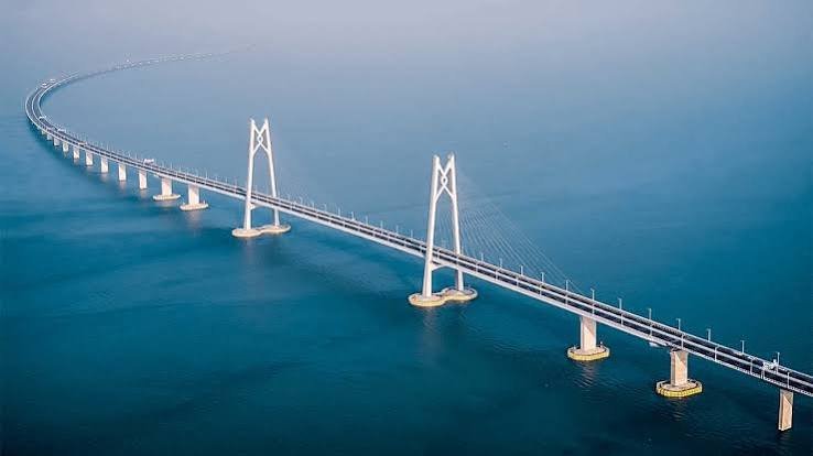
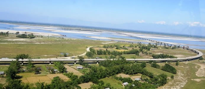
Dhola Sadiya Bridge, officially known as Bhupen Hazarika Setu, is one of the most important road bridges in Northeast India. Stretching 9.15 km across the Lohit River, a major tributary of the Brahmaputra, the bridge connects Dhola in Assam’s Tinsukia district with the Sadiya side and provides a crucial road gateway towards eastern Arunachal Pradesh.
The bridge was inaugurated on May 26, 2017. At the time of opening, it was India’s longest bridge and transformed a region where dependable river crossing had previously relied heavily on ferry services. The permanent connection significantly reduced both travel distance and journey time between Upper Assam and eastern Arunachal Pradesh.
Dhola Sadiya Bridge also has strategic importance. It was engineered to carry heavy military vehicles weighing up to 60 tonnes, including Arjun and T-72 tanks, giving it an important role in improving defence mobility towards India’s northeastern border regions.
Quick Overview of Dhola Sadiya Bridge
| Particular | Details |
| Official Name | Bhupen Hazarika Setu |
| Common Name | Dhola Sadiya Bridge |
| Location | Tinsukia district, Assam |
| River | Lohit River |
| Bridge Type | Beam road bridge |
| Total Length | 9.15 km |
| Connects | Dhola with the Sadiya side |
| Opened | May 26, 2017 |
| Used For | Road traffic |
| Railway Line | No |
| Major Regional Role | Upper Assam–eastern Arunachal Pradesh connectivity |
| Strategic Capacity | Designed for military vehicles up to 60 tonnes |
| Nearby Areas | Dhola, Sadiya, Chapakhowa, Saikhowa and Tinsukia |
| Important Onward Destination | Roing, Arunachal Pradesh |
| Known For | Long river crossing and strategic Northeast connectivity |
The Assam government describes Bhupen Hazarika Setu as the first permanent road connection between northern Assam and eastern Arunachal Pradesh.
Where is Dhola Sadiya Bridge Located?
Dhola Sadiya Bridge is located in the eastern part of Tinsukia district in Assam. It crosses the Lohit River between Dhola on the southern side and the Sadiya region to the north.
The location is significant because this part of Assam lies close to Arunachal Pradesh. Before the bridge opened, river conditions could make regular movement difficult, particularly during the monsoon when ferry-based connectivity was vulnerable to flooding.
The bridge consequently serves not only villages around Sadiya but also travellers continuing towards Roing and other parts of eastern Arunachal Pradesh.
Tinsukia remains the major commercial and railway centre on the Assam side, making the bridge important for people travelling between the city and communities north of the Lohit.
Dhola Sadiya Bridge Route and Road Connectivity
The principal function of Dhola Sadiya Bridge is to create a direct road link across the Lohit River.
Important connections include:
- Dhola: The southern-side settlement from which the bridge takes part of its common name.
- Sadiya: Important historic and administrative area north of the bridge.
- Chapakhowa: Important town in the wider Sadiya region and a road gateway towards Arunachal Pradesh.
- Tinsukia: Major commercial, railway and transport centre in Upper Assam.
- Rupai: Important road point on the wider Tinsukia-side route.
- Roing: District headquarters of Lower Dibang Valley in Arunachal Pradesh and one of the most important onward destinations.
- Tezu: Another major eastern Arunachal Pradesh destination accessible through the wider regional road network.
- Dibang Valley region: Connectivity towards this part of Arunachal Pradesh has also benefited from improved permanent river crossings.
When the bridge opened, the Ministry of Road Transport and Highways said the distance between Rupai in Assam and Meka/Roing in Arunachal Pradesh was reduced by about 165 km. Travel time on that connection was expected to fall from around six hours to roughly one hour.
That reduction demonstrates why the bridge had such a major effect on regional travel.
Why is Dhola Sadiya Bridge Important?
The bridge solved a geographical problem that had affected this part of Northeast India for decades.
The Lohit and Brahmaputra river system creates enormous natural barriers. Ferries can provide useful connectivity, but river conditions, floods and daylight restrictions make them less dependable than a permanent road bridge.
Bhupen Hazarika Setu created a 24-hour road connection between Upper Assam and eastern Arunachal Pradesh, replacing the earlier dependence on ferry-based movement for this particular crossing.
Its benefits include:
- Faster passenger travel
- Easier movement of agricultural produce
- Better access to markets
- Improved healthcare and educational travel
- More dependable commercial transport
- Better access towards Arunachal Pradesh
- Faster movement of defence personnel and equipment
The bridge therefore serves local communities while also forming part of the much larger strategic transport network of Northeast India.
Traffic Conditions on Dhola Sadiya Bridge
Traffic conditions on Dhola Sadiya Bridge are very different from heavily congested urban bridges in cities such as Mumbai, Pune or Kolkata.
There are no major city intersections in the middle of the crossing. Traffic mainly consists of cars, two-wheelers, buses, commercial vehicles and regional traffic travelling between Upper Assam and the Sadiya-Arunachal side.
The main travel considerations are therefore generally associated with the approach roads and wider regional route, rather than conventional signal congestion on the bridge itself.
Weather is also relevant. The bridge crosses a vast river and floodplain environment where the monsoon has historically affected transportation. One of the original purposes of the project was to replace ferry connectivity that could become unreliable during floods.
Travellers heading farther into Arunachal Pradesh should also consider mountain-road conditions beyond the bridge, particularly during periods of heavy rain.
How Dhola Sadiya Bridge Changed Travel to Arunachal Pradesh
The bridge’s greatest practical achievement is the transformation of travel towards eastern Arunachal Pradesh.
Before the permanent crossing opened, reaching destinations on the opposite side involved ferry travel or much longer road journeys.
The 2017 government assessment showed a 165-km reduction in distance between Rupai and the Meka/Roing side, with a potential saving of around five hours.
Roing remains strongly connected with Tinsukia. The Lower Dibang Valley district administration currently lists New Tinsukia Junction at about 102 km from Roing and says buses and cabs operate between Tinsukia and Roing throughout the day.
This connection is important for residents of Arunachal Pradesh who depend on Tinsukia for railway services, business, healthcare and other facilities.
Engineering and Strategic Importance
Bhupen Hazarika Setu is a beam bridge extending 9.15 km over the Lohit River. Its exceptional length was necessary because the river and surrounding floodplain spread across a very wide area.
The bridge was also designed with defence requirements in mind.
Official government information states that it is capable of supporting 60-tonne military tanks, including the Indian Army’s Arjun and T-72 models.
This capability makes the bridge strategically significant because eastern Arunachal Pradesh contains important border areas where reliable transport infrastructure is essential.
Civilian and military requirements therefore overlap at Dhola Sadiya Bridge. The same structure that allows residents to reach markets and hospitals can also support large-scale logistical movement towards the northeastern frontier.
Construction and Naming of the Bridge
Planning for a permanent crossing took several years.
The Assam government records that a feasibility study began in 2003, while the project was approved for construction in 2009 as part of the Arunachal Pradesh Package of Roads and Highways. Construction began in November 2011 and was completed in 2017.
The bridge was inaugurated on May 26, 2017. On the same occasion, the government announced that it would be named Bhupen Hazarika Setu in honour of Dr Bhupen Hazarika, the celebrated Assamese musician, poet and cultural figure.
The name is particularly meaningful because Bhupen Hazarika was born in Sadiya and became closely associated with Assam and the Brahmaputra through his music and cultural work.
Dhola Sadiya Bridge and Tourism
The bridge has also become a recognised tourist attraction in Tinsukia district.
The Government of Assam lists Dhola-Sadiya Bridge among the places of interest in Tinsukia, alongside attractions such as Dibru-Saikhowa National Park, Dehing Patkai National Park, Digboi and the historic Stilwell Road.
Its appeal comes largely from the scale of the structure. For much of the journey, travellers are surrounded by the enormous river landscape and floodplain, creating a very different experience from driving over an ordinary urban bridge.
The bridge can also form part of a larger road trip towards Sadiya, Roing and the scenic areas of eastern Arunachal Pradesh.
Visitors continuing into Arunachal Pradesh should, however, arrange the required travel permit before proceeding.
Public Transport and Travel Facilities
Road transport is the primary mode of public transport around Dhola Sadiya Bridge.
Buses, shared vehicles and taxis connect the wider Tinsukia region with Sadiya and destinations in Arunachal Pradesh. Roing district authorities specifically state that buses and cabs operate between Tinsukia and Roing throughout the day.
For rail travellers, New Tinsukia Junction is the major railway gateway.
The bridge itself does not carry trains. It is exclusively a road crossing, unlike Assam’s Bogibeel Bridge, which combines road and railway infrastructure.
Nearby Areas to Dhola Sadiya Bridge
- Dhola: The principal settlement on the southern approach and one end of the bridge.
- Sadiya: Historic region on the northern side and an important gateway towards Arunachal Pradesh.
- Chapakhowa: Important commercial and administrative town serving the Sadiya region.
- Saikhowa: Area in the wider eastern Tinsukia district road network.
- Tinsukia: Major city and transport centre providing railway, commercial and healthcare facilities.
- Roing: Important Arunachal Pradesh town whose connectivity with Tinsukia was substantially improved by the permanent river crossing.
- Tezu: Major eastern Arunachal Pradesh destination accessible through onward regional roads.
FAQs About Dhola Sadiya Bridge Assam
Q1. Is Dhola Sadiya Bridge only for road vehicles?
Yes. Bhupen Hazarika Setu is a road bridge and does not carry railway tracks. This distinguishes it from Assam’s Bogibeel Bridge, which has separate road and railway decks.
Q2. Do travellers need an Inner Line Permit to cross the bridge?
The bridge itself is located on the Assam-side regional route, but travellers who continue into Arunachal Pradesh need to follow the state’s permit rules. The Government of Arunachal Pradesh states that an Inner Line Permit is required for eligible Indian visitors entering the state, while foreign nationals use the applicable protected-area permit system.
Q3. Can heavy military vehicles use Dhola Sadiya Bridge?
Yes. The bridge was specifically designed to support loads of up to 60 tonnes, including Arjun and T-72 military tanks.
Q4. Is Dhola Sadiya Bridge the same as Bogibeel Bridge?
No. Dhola Sadiya Bridge crosses the Lohit River and is a road-only bridge connecting the Dhola-Sadiya region. Bogibeel Bridge crosses the Brahmaputra near Dibrugarh and is a double-deck rail-cum-road bridge.
Q5. Does the bridge make travelling to Roing easier?
Yes. Improved access towards Roing is one of the bridge’s major benefits. At inauguration, the government estimated that the Rupai–Meka/Roing journey would become about 165 km shorter, reducing travel time dramatically compared with the previous route.