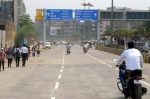
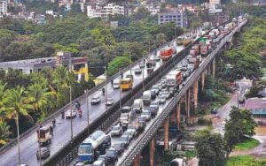
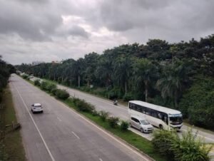
Matangini Bridge, officially known as Sahid Matangini Setu, is an important road bridge over the Haldi River near Narghat in Purba Medinipur district, West Bengal. It lies on the Tamluk–Contai road corridor and provides a direct road crossing between the Tamluk side and the routes leading towards Nandakumar, Contai, Digha and other parts of coastal Purba Medinipur.
The bridge is named after Matangini Hazra, the celebrated freedom fighter from the Tamluk region who was killed during the Quit India Movement in 1942. The bridge itself was completed and opened in 1982. Published bridge records give its length as 521.309 metres, or about 521 metres, and describe it as a prestressed-concrete bridge supported on circular well foundations.
For travellers, Matangini Setu is more than a local river crossing. It forms part of a heavily used regional route linking Tamluk with the Contai and Digha side of the district. It is also important for residents travelling between Nandakumar, Chandipur, Nandigram-side areas and Tamluk for work, education, healthcare and railway connections.
Quick Overview of Matangini Bridge
| Particular | Details |
| Official Name | Sahid Matangini Setu |
| Common Name | Matangini Bridge / Matangini Setu |
| Location | Narghat, near Tamluk, Purba Medinipur, West Bengal |
| River | Haldi River |
| Bridge Type | Prestressed-concrete road bridge |
| Approximate Length | 521.309 metres |
| Foundation Type | Circular well foundation |
| Opened | 1982 |
| Road Corridor | Tamluk–Contai Road |
| Main Connections | Tamluk, Nandakumar, Contai and Digha-side routes |
| Nearby Areas | Narghat, Tamluk, Nandakumar, Chandipur and Nimtouri |
| Vehicle Use | Road traffic, including regional passenger and commercial vehicles |
| Toll | The former Norghat/Matangini Setu toll collection centre was abolished by West Bengal PWD |
| Known For | Key Haldi River crossing on the Tamluk–Contai corridor |
Where is Matangini Bridge Located?
Matangini Bridge crosses the Haldi River at Narghat in Purba Medinipur. The West Bengal Public Works Department has identified the location as the Norghat Bridge, popularly known as Matangini Setu, on the Tamluk–Contai Road. The bridge is associated with the 18 km to 20 km stretch of that road corridor.
Tamluk lies to the north-west of the crossing, while Nandakumar is one of the most important road junctions to the south-east. From Nandakumar, travellers can continue towards Contai, Digha, Haldia, Chandipur and other destinations through the wider highway and state-road network.
The bridge therefore sits at a useful transition point between the Tamluk urban area and the coastal and southern parts of Purba Medinipur.
Matangini Bridge Route and Road Connectivity
The bridge is primarily important because it carries regional road traffic across the Haldi. It is part of the long-established Tamluk–Contai travel corridor and feeds into major roads around Nandakumar.
- Tamluk: District headquarters and the main urban centre north-west of the bridge.
- Nandakumar: Major junction for onward travel towards Contai, Digha and Haldia-side routes.
- Contai (Kanthi): Important town and commercial centre on the coastal side of Purba Medinipur.
- Digha: Major seaside destination reached by continuing through the Contai corridor.
- Chandipur: Important block and road connection east of Nandakumar.
- Nandigram direction: Accessible through connecting roads from the Nandakumar and Chandipur side.
- Haldia: Major industrial and port city connected through the wider Purba Medinipur road network.
- Mecheda and Kolaghat: Important gateways for traffic continuing towards Kolkata and National Highway 16.
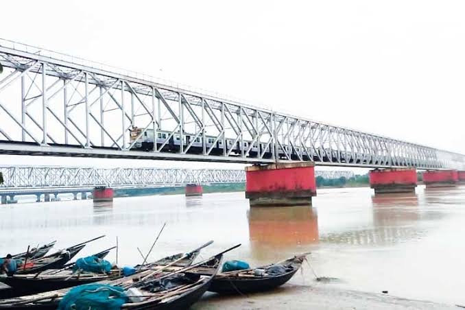
The bridge should not be confused with the nearby railway crossing over the Haldi. Matangini Setu is the road bridge used by normal vehicles.
Why is Matangini Bridge Important?
Before the road bridge opened, the Haldi formed a major obstacle on direct road travel between Tamluk and the Contai-Digha side. Contemporary reporting on the bridge’s history notes that its opening removed a major barrier on this corridor and significantly improved movement between Tamluk, Nandakumar and the coastal part of the district.
The bridge is useful for daily commuters, buses, private cars, goods vehicles and people travelling to Tamluk for government offices, hospitals, colleges and railway services. It is equally useful in the opposite direction for travellers heading towards Contai, Digha and the Nandigram-side road network.
Its regional role is strengthened by the fact that Purba Medinipur is a large district with four subdivisions—Tamluk, Haldia, Contai and Egra—and extensive movement between inland towns, industrial areas and the coast.
Traffic Conditions at Matangini Bridge
Matangini Setu carries through traffic rather than only neighbourhood traffic. Vehicles using the Tamluk–Contai corridor mix with local movement around Narghat and Nandakumar, so the approaches can become busy even when traffic is flowing steadily on the central bridge span.
Traffic is generally more likely to build up during morning and evening commuting periods, weekends and holiday travel towards Digha, major local festivals and temporary road works on the approach corridors.
The bridge also carries commercial and inter-district movement. Drivers approaching from Tamluk should pay attention to traffic conditions around the Nandakumar junction, because delays there can affect onward journeys towards Contai and Digha even after the river crossing itself has been completed.
Construction and Engineering of Matangini Setu
Published West Bengal bridge records describe Matangini Setu as a 521.309-metre prestressed-concrete bridge with circular well foundations. This type of foundation is commonly used for large river bridges because the wells can be sunk deep into the riverbed to provide stable support for the piers.
The bridge was started in the 1960s and completed in 1982. A 2018 report in Anandabazar Patrika recorded that the Public Works Department began construction in 1966 and that the crossing was finally opened in 1982.
The same report said a major renovation had been carried out in 2011. The age of the bridge makes periodic inspection and maintenance particularly important because it continues to carry significant regional road traffic.
Maintenance and Structural History
Matangini Setu attracted renewed attention in 2018 after the Majerhat bridge collapse in Kolkata prompted wider concern about ageing bridges across West Bengal. At that time, PWD officials said the Haldi River bridge had recently been inspected and no dangerous condition had been found, while maintenance work was to be incorporated into the wider road-improvement programme.
That 2018 inspection should be understood as historical information rather than a substitute for a current structural certificate. For present-day users, the practical point is that the bridge remains an established road crossing and its age makes regular maintenance an important part of the corridor’s upkeep.
A recent NHAI/MoRTH project database also lists maintenance and patch-repair works on the NH-116B network under the Tamluk NH subdivision during 2024–25, showing that the wider coastal highway system continues to receive maintenance attention.
Matangini Bridge and the Digha Route
One reason the bridge is familiar to travellers beyond Tamluk is its role in the broader Kolkata–Digha road journey. The bridge lies before the Nandakumar junction for many Tamluk-side trips, after which traffic can continue towards Contai and Digha through the coastal highway network.
NH-116B begins at Nandakumar and runs towards Contai, Digha and Chandaneswar. Matangini Setu itself is identified by West Bengal PWD as being on the Tamluk–Contai road, so the most accurate way to describe its role is as a feeder and direct crossing on the approach to the Nandakumar–Contai–Digha corridor rather than simply labelling the bridge itself as NH-116B.
This distinction is useful for route planning because road numbers around Tamluk, Nandakumar and the coastal corridor can otherwise be confusing.
Who Was Matangini Hazra?
The bridge is named after Matangini Hazra, one of the most respected figures associated with the freedom movement in the Tamluk region. She was born in the area and became known for taking part in the Indian independence movement despite her advanced age.
She was killed on 29 September 1942 during the Quit India Movement while participating in a procession in Tamluk. Her association with the district is reflected not only in the bridge name but also in the Sahid Matangini community development block and Sahid Matangini railway station.
The name therefore gives the bridge a local historical identity in addition to its practical transport role.
Public Transport Near Matangini Bridge
Buses and other road-based public transport use the Tamluk–Nandakumar–Contai corridor, making the bridge accessible without a private vehicle. Tamluk and Nandakumar are the most useful transport points on either side of the wider route.
Tamluk railway station is an important rail connection for the district. Current Indian Railways schedules for Digha-bound services show Tamluk and Kanthi among the stops on the coastal rail corridor, giving travellers another option for journeys between the Tamluk and Digha regions.
Autos, shared vehicles and local buses are available in the larger towns, although service frequency can be lower in smaller roadside settlements around Narghat.
Major Landmarks and Facilities Near Matangini Bridge
- Haldi River: The river crossed by Matangini Setu and the main geographical feature of the site.
- Tamluk: Historic district headquarters with administrative, educational and medical facilities.
- Nandakumar Junction: Major road interchange for Contai, Digha, Haldia and neighbouring blocks.
- Nimtouri: Important administrative area near Tamluk where the Purba Medinipur district administrative complex is located.
- Sahid Matangini area: Tamluk subdivision block named after the same freedom fighter.
- Tamluk Railway Station: Important railhead for local and regional travel.
Nearby Areas to Matangini Bridge
- Narghat: The locality most directly associated with the bridge and the Haldi River crossing.
- Tamluk: Main city and district headquarters on the north-western side of the corridor.
- Nandakumar: Important junction and town south-east of the bridge.
- Chandipur: Nearby block and road corridor on the route towards the eastern and coastal part of the district.
- Nimtouri: Administrative area near Tamluk and an important local landmark.
- Contai: Major town farther along the route towards Digha and the coast.
FAQs About Matangini Bridge Tamluk
Q1. Is Matangini Bridge the same as Sahid Matangini Setu?
Yes. Sahid Matangini Setu is the formal name, while Matangini Bridge or Matangini Setu is commonly used for the road bridge over the Haldi River at Narghat.
Q2. Is there a toll at Matangini Bridge?
West Bengal PWD published a notification stating that the toll collection centre at Norghat Bridge, popularly known as Matangini Setu, was abolished. Travellers should therefore not confuse old references to the Norghat toll centre with a current routine bridge toll.
Q3. Is Matangini Bridge on the direct road towards Digha?
It is an important crossing on the Tamluk–Contai corridor. From the Nandakumar side, travellers can join the road network towards Contai and Digha, including the NH-116B corridor beginning at Nandakumar.
Q4. Is Matangini Setu a road bridge or railway bridge?
It is a road bridge. A separate railway alignment also crosses the Haldi in the wider area, so the two structures should not be confused.
Q5. Why is the bridge named Matangini?
It honours Matangini Hazra, the freedom fighter associated with Tamluk who was killed during the Quit India Movement in 1942.
Q6. When was Matangini Bridge last known to have undergone major renovation?
A 2018 report recorded a major renovation in 2011. Because maintenance can occur in smaller phases, that date should be treated as the last clearly documented major renovation in the sources reviewed rather than the only maintenance work ever carried out.