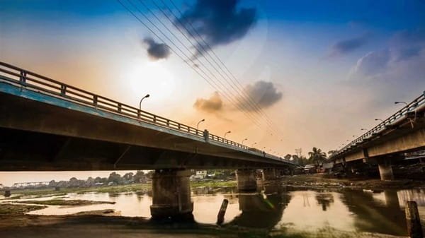
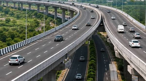
Basin Bridge is one of the oldest and busiest road-over-bridge corridors in North Chennai, Tamil Nadu. Located close to Basin Bridge Junction railway station, the structure carries road traffic above an extensive railway network and connects important North Chennai routes towards Wall Tax Road, Mint, Vyasarpadi, Pulianthope and Korukkupet. Greater Chennai Corporation officially lists Basin Bridge as a road overbridge north of Basin Bridge Railway Station.
The bridge has a much longer history than most road flyovers in Chennai. Contemporary reporting traces its construction to the 1869–1873 period, making it a legacy transport structure that now has to handle traffic volumes far beyond what its original configuration was designed for. In 2025, more than 20,000 vehicles were reported to use the bridge during peak periods, while by June 2026 traffic police were recording peak flows of roughly 5,000–6,000 vehicles per hour at the surrounding junction.
Basin Bridge is also closely associated with one of Chennai’s most important railway areas. Basin Bridge Junction is immediately south of the road structure and serves as the point where railway lines from Chennai Central branch towards different routes. This concentration of roads, railway tracks and neighbourhood traffic makes Basin Bridge one of North Chennai’s most complicated transport locations.

Quick Overview of Basin Bridge
| Particular | Details |
| Name | Basin Bridge |
| Location | North Chennai, Tamil Nadu |
| Structure Type | Road overbridge |
| Located Near | Basin Bridge Junction Railway Station |
| Historic Construction Period | 1869–1873, according to contemporary reporting |
| Major Road Corridor | Basin Bridge Road / GNT Road-side network |
| Major Connections | Wall Tax Road, Mint, Vyasarpadi, Pulianthope and Korukkupet |
| Nearby Areas | Basin Bridge, Pulianthope, Washermanpet, Mint, Vyasarpadi and George Town |
| Railway Connection | Basin Bridge Junction |
| Public Transport | MTC buses, suburban trains, Metro from nearby stations, autos and cabs |
| Traffic Character | Heavy urban and commuter traffic |
| Current Status | Operational |
| Major Issue | Narrow capacity and severe peak-hour congestion |
| Future Requirement | Widening or reconstruction under discussion |
| Known For | Historic North Chennai road and railway corridor |
A dependable standalone bridge length and original engineering dimensions are not consistently available in authoritative current records, so they are better omitted rather than mixed with measurements belonging to nearby Elephant Gate or Cochrane Basin bridges.
Where is Basin Bridge Located?
Basin Bridge is located in North Chennai, close to Pulianthope, Mint and Basin Bridge Junction railway station. Greater Chennai Corporation places the road overbridge in Ward 54, immediately north of the railway station.
The surrounding transport network links several densely populated neighbourhoods, including:
- Vyasarpadi
- Pulianthope
- Korukkupet
- Mint/Vallalar Nagar
- Washermanpet
- George Town
- Royapuram
The bridge area also lies close to the Buckingham Canal system, which meets other drainage channels around Basin Bridge. The combination of water channels and dense railway infrastructure has historically constrained the amount of space available for expanding roads in this part of Chennai.
Basin Bridge Route and Road Connectivity
Basin Bridge acts as a major distributor of road traffic between North Chennai and the central parts of the city.
Important route connections include:
- Wall Tax Road: Major route towards Chennai Central and George Town.
- Vyasarpadi: Accessible through Basin Bridge Road and adjoining flyover connections.
- Mint/Vallalar Nagar: Busy commercial and public-transport area close to the junction.
- Korukkupet: Connected through roads towards the northern and eastern side.
- Pulianthope: Major residential neighbourhood adjoining Basin Bridge.
- MKB Nagar and Kodungaiyur: Reached through Vyasarpadi-side roads.
- Chennai Central: Accessible southwards through Wall Tax Road and Elephant Gate-side routes.
- Grand Northern Trunk Road: Important corridor for traffic heading farther north.
Traffic arrangements around Basin Bridge are not always straightforward. One-way systems and diversions have been used repeatedly because several roads converge within a small area.
Why is Basin Bridge Important?
Basin Bridge is important because it allows road vehicles to pass across a major railway corridor immediately north of Chennai Central.
The nearby Basin Bridge Junction is particularly significant to Southern Railway. Railway lines leaving the terminal at Chennai Central branch through this area towards different destinations, while the Basin Bridge coaching depot is also used for train maintenance.
For road users, the bridge supports:
- Daily North Chennai commuters
- MTC buses
- School and college traffic
- Two-wheelers and cars
- Commercial vehicles
- Ambulances travelling towards major hospitals
- Traffic heading towards Central Chennai
Its role became even more evident when nearby bridges were under construction or temporarily restricted. Traffic diverted from other North Chennai projects has repeatedly increased pressure on Basin Bridge.
Traffic Conditions at Basin Bridge
Congestion is currently the biggest practical issue at Basin Bridge.
A June 2026 assessment found that motorists could spend around 30 minutes crossing the Basin Bridge junction during the evening peak. The four-way junction handles movements from Wall Tax Road, Vyasarpadi, Korukkupet and Mint, while local diversions push additional traffic through narrow surrounding streets.
Traffic police reported peak flows of approximately 5,000–6,000 vehicles per hour, making conventional signal management difficult. Attempts to restore direct movements at the junction were unsuccessful because queues quickly overwhelmed the available road capacity.
Congestion is usually worse during:
- Morning and evening commuting hours
- School and office timings
- Bus breakdowns or vehicle incidents
- Nearby flyover construction
- Road and drainage works
- Heavy rain
- Diversions from neighbouring bridges
A bus breakdown in February 2025, for example, produced queues across Basin Bridge Flyover, Vyasarpadi and surrounding roads until the vehicle could be removed.
Why Basin Bridge Has Become a Bottleneck
The most important problem is the gap between the bridge’s historic configuration and modern traffic demand.
Reports describe the structure as dating from the late 19th century, while the neighbourhoods around it have since become some of Chennai’s most densely travelled urban areas.
The bridge effectively feeds into a complicated junction where vehicles arrive from several directions. The recent shift of the Mint bus terminus towards this area has added further pressure, while motorists making unauthorised turns can block several directions at once.
Traffic police told Times of India in June 2026 that widening the existing four-lane corridor to six lanes would be one of the most effective long-term solutions.
Proposed Widening and Reconstruction
Replacing or widening Basin Bridge has been discussed for several years.
A reconstruction proposal was reportedly developed as early as 2019, but progress was complicated because part of the proposed alignment would pass above active railway tracks and electrical transmission infrastructure. Railway clearance therefore became a major hurdle.
In April 2025, Tamil Nadu’s Highways Minister said the government would inspect the site and examine whether the existing bridge could be widened or a new bridge constructed. By July of that year, however, a final redevelopment programme had not moved forward.
By June 2026, officials were again discussing a fresh proposal. One concept involves extending the Basin Bridge flyover arm across the existing junction, allowing through traffic between the Mint and Basin Bridge sides to bypass the signal. This could simplify the existing four-way conflict into a less complicated road arrangement.
As of August 2026, this should still be treated as a proposal rather than an operational new bridge.
Basin Bridge and Railway Junction Are Different
- The names can easily cause confusion.
- Basin Bridge generally refers to the road bridge/flyover and the surrounding neighbourhood.
- Basin Bridge Junction is the railway station immediately nearby.
- The station is a major Southern Railway operating point because lines originating from Chennai Central separate here. It is also located close to the large Basin Bridge coaching depot used for maintaining passenger trains.
- The road bridge passes above railway infrastructure north of the station, which is why Greater Chennai Corporation officially categorises it as a road overbridge rather than an ordinary canal or river bridge.
One-Way Traffic and Junction Management
- Traffic circulation around Basin Bridge has been modified several times.
- A major one-way arrangement introduced in 2019 prevented vehicles from Wall Tax Road from directly crossing certain movements at Basin Bridge Road. Traffic was instead redistributed through Moolakothalam Road and surrounding streets.
- Further trial diversions were introduced in 2020, and variations of these arrangements have continued as nearby infrastructure has changed.
- In June 2026, additional traffic changes were introduced around Elephant Gate because of Greater Chennai Corporation drainage work. Vehicles travelling between Central, Choolai and Basin Bridge had to follow specific one-way routes through Elephant Gate and Wall Tax Road.
- For regular commuters, this means the quickest route can vary depending on current traffic-control measures.
Public Transport Near Basin Bridge
Basin Bridge has strong public-transport connectivity.
Suburban Railway
Basin Bridge Junction Railway Station serves Chennai’s suburban railway network and lies immediately beside the bridge corridor. It is also the first major railway junction after trains leave Chennai Central.
Bus Services
MTC buses use Basin Bridge Road, Mint, Wall Tax Road and neighbouring routes. Vallalar Nagar/Mint is an important bus hub close to the bridge.
Metro
The wider North Chennai area can also be accessed through Washermanpet Metro Station and other stations on Chennai Metro’s northern corridor. The Metro station is not directly on the bridge, so local bus, auto or road transport may still be required for the final connection.
Chennai Central
Puratchi Thalaivar Dr. M.G. Ramachandran Central Railway Station lies only a few kilometres south of the Basin Bridge area, strengthening the bridge’s role as a gateway into central Chennai.
Major Landmarks and Facilities Near Basin Bridge
Important landmarks around the bridge include:
- Basin Bridge Junction Railway Station
- Basin Bridge Coaching Depot
- Vallalar Nagar/Mint Bus Terminus
- Wall Tax Road
- Buckingham Canal
- Pulianthope
- Vyasarpadi
- Elephant Gate Bridge
- Chennai Central Railway Station
- Stanley Medical College and Hospital
The bridge is therefore located within one of Chennai’s most infrastructure-intensive urban belts.
Nearby Areas to Basin Bridge
- Pulianthope: Dense residential locality immediately connected with Basin Bridge Road.
- Vyasarpadi: Major North Chennai neighbourhood reached through the bridge and adjoining flyover network.
- Mint/Vallalar Nagar: Busy commercial and bus-transport area close to the southern side of the junction.
- Korukkupet: Important railway and residential locality northeast of Basin Bridge.
- Washermanpet: Major North Chennai residential and commercial area with suburban railway and Metro connectivity.
- George Town: Historic commercial district towards the Chennai Central and Parrys side.
- Royapuram: Important North Chennai locality accessible through the wider road network.
FAQs About Basin Bridge Chennai
Q1. Is Basin Bridge the same as Elephant Gate Bridge?
No. Basin Bridge and Elephant Gate Bridge are separate road-over-bridge structures in North Chennai. Elephant Gate Bridge is closer to Chennai Central, while Basin Bridge lies farther north beside Basin Bridge Junction railway station.
Q2. Is Basin Bridge currently open to traffic?
Yes. Basin Bridge remains operational, although congestion and temporary diversion arrangements can affect the approaches. As of August 2026, proposals to widen or reconstruct it have not replaced the existing bridge.
Q3. Why is traffic so heavy at Basin Bridge?
The bridge feeds into a busy four-way junction carrying traffic from Wall Tax Road, Mint, Vyasarpadi and Korukkupet. Its limited road capacity, bus movement, local streets and illegal turning movements further reduce traffic flow during peak hours.
Q4. Is a new Basin Bridge being built?
Not yet. Widening and reconstruction options are being discussed, including extending the flyover across the junction, but railway and infrastructure clearances remain necessary. No completed replacement bridge was operational as of August 2026.
Q5. Does Basin Bridge cross railway tracks?
Yes. Greater Chennai Corporation officially categorises Basin Bridge as a road overbridge north of Basin Bridge Railway Station, and road-accident reporting also describes it as a rail overpass with railway tracks below.