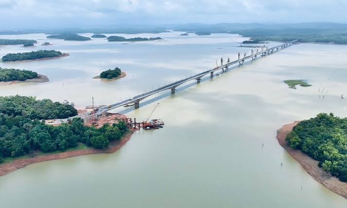
Sigandur Bridge is a major new road bridge across the Sharavathi backwaters in Sagara taluk of Shivamogga district, Karnataka. Also known as the Ambaragodlu-Kalasavalli Bridge and associated with the name Sigandur Chowdeshwari Bridge, it provides a permanent road connection across a water barrier that had forced local residents and pilgrims to depend on ferry services for decades.
The 2.44-km-long and 16-metre-wide bridge was inaugurated on July 14, 2025, by Union Road Transport and Highways Minister Nitin Gadkari. It is recognised as India’s second-longest cable-stayed bridge and was constructed at a cost of more than ₹470 crore.
Its importance goes well beyond its engineering design. The bridge has substantially improved travel between Sagara and the Sigandur region, provided easier access to the famous Sigandur Chowdeshwari Temple and strengthened the road connection between Karnataka’s Malnad and coastal regions.
Quick Overview of Sigandur Bridge
| Particular | Details |
| Name | Sigandur Bridge |
| Other Name | Ambaragodlu-Kalasavalli Bridge |
| Location | Sagara taluk, Shivamogga district, Karnataka |
| Water Body | Sharavathi backwaters |
| Bridge Type | Cable-stayed road bridge |
| Bridge Length | About 2.44 km |
| Width | About 16 metres |
| Opened | July 14, 2025 |
| Project Cost | Around ₹472 crore |
| Major Road | NH-369E corridor |
| Connects | Ambaragodlu and Kalasavalli |
| Nearby Places | Sagara, Sigandur, Kalasavalli, Tumari and Holebagilu |
| Important Pilgrimage Site | Sigandur Chowdeshwari Temple |
| Known For | Major Sharavathi crossing and improved Sigandur connectivity |
| Previous Main Crossing Method | Vehicle ferry/barge |
Government sources give the bridge itself as approximately 2.44 km long, while a PIB release describes the wider bridge-and-approach project as extending about 6.18 km. These figures refer to different project components and should not be treated as conflicting bridge lengths.
Where is Sigandur Bridge Located?
Sigandur Bridge is located across the Sharavathi reservoir backwaters near Ambaragodlu and Kalasavalli villages in Sagara taluk. The area lies within Shivamogga district’s Malnad region, where reservoirs, forested hills and scattered villages make road connectivity challenging.
The bridge forms part of the road network towards Sigandur and the coastal side of Karnataka. It is associated with NH-369E, which provides connectivity through places such as Sagara, Avinahalli, Holebagilu, Kalasavalli and the Sigandur side before continuing towards Marakutika.
One of the main destinations served by the crossing is the Sri Sigandur Chowdeshwari Temple, a well-known pilgrimage centre attracting visitors from different parts of Karnataka. The new bridge has made approaching the temple from the Sagara side significantly easier.
Sigandur Bridge Route and Road Connectivity
The bridge has created a continuous road route across the Sharavathi backwaters instead of requiring vehicles to board a ferry.
Important connections include:
- Sagara: The main town and transport centre for travellers approaching Sigandur from Shivamogga and other parts of Karnataka.
- Holebagilu: Traditionally an important ferry-side reference point on the Sagara-Sigandur journey.
- Ambaragodlu: One of the settlements at the bridge crossing.
- Kalasavalli: Located on the opposite side of the Sharavathi backwaters and connected by the bridge.
- Sigandur: Important pilgrimage destination known for Chowdeshwari Temple.
- Tumari: Local settlement within the wider Sharavathi backwater region.
- Kollur: The bridge strengthens the larger route towards the coastal region and Kollur Mookambika Temple.
- Coastal Karnataka: Improved road continuity helps travel between Malnad and coastal destinations.
The Ministry of Road Transport and Highways specifically identified improved connectivity between the Malnad and coastal regions, along with easier access to both Sigandur Chowdeshwari and Kollur Mookambika temples, as important benefits of the project.
Why is Sigandur Bridge Important?
The importance of Sigandur Bridge can be understood only by looking at the history of the surrounding region.
Construction of the Linganamakki Dam in the 1960s created the large Sharavathi reservoir and separated several communities that had previously been connected by land routes. Residents subsequently depended heavily on ferries and barges to move people and vehicles across the backwaters.
Ferry travel had practical limitations. Services were dependent on operating hours and water conditions, while queues could become long when large numbers of pilgrims travelled towards the Chowdeshwari Temple. Before the bridge opened, reports noted that visitors could sometimes wait several hours for the vehicle barge during peak periods.
The bridge has therefore provided:
- All-day road connectivity across the backwaters
- Faster access to Sigandur
- Easier movement for local residents
- Better bus connectivity
- Improved tourism and pilgrimage travel
- More convenient movement of goods
- Stronger links between Malnad and coastal Karnataka
For surrounding villages, this is a fundamental transport improvement rather than simply a new sightseeing structure.
Traffic Conditions on Sigandur Bridge
Sigandur Bridge does not face the type of daily urban congestion seen on major city flyovers. Traffic largely consists of local vehicles, pilgrims, tourist vehicles, buses and motorists travelling through the Sagara-Sigandur-coastal corridor.
However, traffic increased noticeably after the bridge opened. Within days of its inauguration, KSRTC officials reported an increase in vehicles travelling towards Sigandur and began planning additional bus services to serve the newly accessible route.
Traffic is likely to be heavier during:
- Weekends
- Temple festivals
- Public holidays
- Dasara and other major religious periods
- Peak tourist seasons
- Large pilgrimage gatherings
Demand during the 2025 Dasara season illustrates the effect of the improved road connection. KSRTC introduced Sigandur into its temple-tour packages after the bridge opened, and the route attracted strong passenger numbers.
The bridge itself provides a continuous crossing without the delays involved in loading vehicles onto ferries.
How Sigandur Bridge Replaced Ferry Dependence
Before July 2025, the ferry or vehicle barge across the Sharavathi backwaters was a defining part of travelling to Sigandur from the Sagara side.
Buses, cars and other vehicles could be transported across the reservoir on barges. While the journey offered scenic views, it also created uncertainty. Travellers could face queues, and ferry services did not provide the same continuous access as a permanent bridge.
The bridge changed this completely.
Road vehicles can now travel directly between the two sides without stopping for a ferry transfer. Reports before its inauguration estimated that the new crossing could reduce the Sagara-Sigandur journey by around two hours, with even greater time savings possible during periods when ferry queues were long.
For local residents, the biggest benefit is reliability. Reaching schools, hospitals, markets and workplaces no longer depends on the availability of a barge.
Engineering and Design of Sigandur Bridge
Sigandur Bridge is notable for its cable-supported design and the unusual landscape through which it passes.
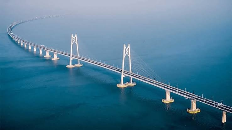
The main bridge is about 2.44 km long and 16 metres wide. Approximately 740 metres form the cable-supported section, according to infrastructure reporting on the project.
The structure uses tall pylons and angled stay cables to support sections of the roadway. This produces the visually distinctive appearance that has already made the bridge a new landmark in Shivamogga district.
The bridge was developed at an estimated cost of approximately ₹472 crore. Construction followed the foundation-laying stage in 2018, with completion taking several years because of the scale of the project and the difficult backwater environment.
Work was also affected by monsoon conditions. Heavy early rains and winds in 2025 delayed final asphalt-related work shortly before inauguration.
Sigandur Bridge and Tourism
The bridge has quickly become an attraction in its own right.
The combination of a modern cable-supported structure, wide reservoir views and forest-covered surroundings gives visitors impressive scenery across the Sharavathi backwaters. After its opening, Sigandur recorded increased tourism interest, and travel operators began including the new bridge in regional itineraries.
The most important nearby attraction remains Sri Sigandur Chowdeshwari Temple. Improved road access means pilgrims can combine the temple visit with other regional destinations more easily.
The bridge also strengthens road-trip possibilities involving:
- Sigandur Chowdeshwari Temple
- Sagara
- Jog Falls
- Kollur Mookambika Temple
- Malnad countryside
- Coastal Karnataka routes
KSRTC and tourism operators have already used the new connectivity to create combined temple and sightseeing services.
Public Transport Near Sigandur Bridge
Road-based public transport has improved considerably since the bridge opened.
Before the permanent crossing, limited bus services operated around the ferry arrangement. After July 2025, KSRTC began planning additional services because buses could travel directly across the new bridge and continue towards more villages throughout the day.
Special services have also been operated from other parts of Karnataka. During Dasara 2025, KSRTC’s Mangaluru division ran package-tour buses to Sigandur, and the new bridge made it possible to combine Sigandur with routes towards Kollur.
Sagara remains the main transport base for many travellers approaching the bridge.
Nearby Areas to Sigandur Bridge
- Ambaragodlu: One of the villages directly associated with the bridge and one end of the new crossing.
- Kalasavalli: Located on the opposite side and forming the other main endpoint of the bridge.
- Sigandur: Famous pilgrimage village associated with Sri Chowdeshwari Temple.
- Holebagilu: Important traditional crossing point on the old ferry-based route.
- Tumari: Settlement in the wider Sharavathi backwater region.
- Sagara: The main nearby town and an important transport, commercial and accommodation centre for visitors.
- Kollur: Major pilgrimage destination on the coastal side whose road connectivity from the Malnad region benefits from the improved crossing.
FAQs About Sigandur Bridge Karnataka
Q1. Is a ferry still necessary to reach Sigandur from Sagara?
Not for the main road journey using the new bridge. The permanent crossing allows vehicles to travel directly across the Sharavathi backwaters, removing the earlier dependence on the vehicle barge for this route.
Q2. Can buses travel across Sigandur Bridge?
Yes. The bridge has enabled expanded bus connectivity, and KSRTC introduced or planned additional services after it opened. Special tourism buses have also used the improved route to Sigandur.
Q3. Why do some sources give different lengths for Sigandur Bridge?
The bridge itself is widely reported at about 2.44 km, while an official PIB release gives 6.18 km for the wider cable-stayed bridge project, which includes additional project components and approaches. For describing the physical bridge, 2.44 km is the more useful figure.
Q4. Is Sigandur Bridge useful for travelling to Kollur?
Yes. The Ministry of Road Transport and Highways specifically states that the new Sharavathi crossing improves access to both Sigandur Chowdeshwari Temple and Kollur Mookambika Temple, strengthening the wider Malnad-to-coastal route.
Q5. Can visitors stop on the bridge for sightseeing?
The bridge is an active highway structure rather than a dedicated tourist promenade. Visitors should follow posted traffic rules and avoid stopping in live traffic lanes simply for photographs. Scenic views are better enjoyed from safe, permitted locations around the backwater area.