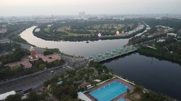
Napier Bridge is one of Chennai’s most recognisable road bridges and an enduring landmark near Marina Beach and Fort St. George. Located on Kamarajar Salai, the bridge crosses the Cooum River close to the point where the river enters the Bay of Bengal. Greater Chennai Corporation officially lists Napier Bridge on Kamarajar Salai near Island Grounds.
The history of the crossing goes back to 1869, when the first iron bridge was constructed during the tenure of Francis Napier, then Governor of Madras. The structure was subsequently rebuilt and modernised several times. The familiar concrete bridge with its repeated white arches dates from the 1940s, while an additional parallel bridge was added in 1999 to provide greater road capacity.
Today, Napier Bridge is much more than an old city crossing. It forms an important connection between the Chennai Port-Fort St. George side and the Marina Beach, Chepauk and Triplicane corridors. Its distinctive arches, prominent waterfront position and night illumination have also made it an architectural symbol of Chennai.
Quick Overview of Napier Bridge
| Particular | Details |
| Name | Napier Bridge |
| Location | Chennai, Tamil Nadu |
| River | Cooum River |
| Major Road | Kamarajar Salai |
| Original Bridge Built | 1869 |
| Present Concrete Structure | 1940s |
| Parallel Bridge Added | 1999 |
| Approx. Length | 149 metres |
| Traffic Capacity | Six lanes across the combined crossing |
| Bridge Material | Concrete |
| Major Connection | Fort St. George/Chennai Port side with Marina Beach and Chepauk |
| Nearby Areas | Fort St. George, Chepauk, Triplicane, Chintadripet and George Town |
| Nearest Practical Metro | Government Estate Metro Station |
| Known For | White arches, heritage, illumination and Marina Beach connectivity |
Lighting-industry project information describes the current bridge as a concrete structure extending about 149 metres, with six long arches.
Where is Napier Bridge Located?
Napier Bridge is located in central Chennai, immediately west of the northern end of Marina Beach. It carries Kamarajar Salai over the Cooum River close to its mouth. The Chennai Rivers Restoration Trust confirms that the Cooum enters the Bay of Bengal downstream of Napier Bridge.
On the northern side lie Fort St. George, the Chennai Port area, Victory War Memorial and Island Grounds. Travelling south from the bridge leads directly onto the long Marina Beach-Kamarajar Salai corridor towards Chepauk, Triplicane, the University of Madras area and farther south along the coast. Greater Chennai Corporation identifies the bridge specifically as being on Kamarajar Salai near Island Grounds.
This location makes Napier Bridge both a transport connection and an important geographical reference point between Chennai’s colonial administrative quarter and its famous seafront.
Napier Bridge Route and Road Connectivity
Napier Bridge primarily carries traffic between the Fort St. George-Rajaji Salai side and Kamarajar Salai along Marina Beach.
Important connections around the bridge include:
- Fort St. George: Historic administrative complex located immediately north of the crossing.
- Marina Beach: The bridge provides direct access to the northern end of the beachfront corridor.
- Chepauk: Reached south along Kamarajar Salai.
- Triplicane: Accessible from the Marina-Chepauk road network.
- George Town: Reached through roads around Fort St. George and Rajaji Salai.
- Chennai Port: Located north-east of the bridge and connected through the port-side road network.
- Anna Salai: Accessible through roads running west from the Island Grounds and Government Estate area.
- Chintadripet: Located west of the Cooum and accessible through the surrounding central-city road network.
The bridge is therefore particularly useful for motorists travelling between North/Central Chennai and the Marina-Chepauk side without making a longer inland detour.
Why is Napier Bridge Important?
Napier Bridge has played an important role in Chennai’s development for more than 150 years.
The original crossing created a permanent connection across the Cooum near its mouth, linking the Fort St. George side with areas developing farther south. Over time, this route became increasingly important as Chepauk, Triplicane and the Marina waterfront developed into major parts of the city.
Today, the bridge remains useful because of the concentration of important destinations around it. Government offices, Chennai Port, Marina Beach, educational institutions, sports facilities and heritage sites all lie within the surrounding central-city zone.
Its second major role is architectural. The sequence of concrete arches gives Napier Bridge a distinctive silhouette, particularly when viewed from the Cooum riverbanks or illuminated after dark. Lighting specialists involved with the bridge have described it as a gateway to Marina Beach and an important feature of Chennai’s urban nightscape.
Traffic Conditions at Napier Bridge
Napier Bridge forms part of an active central Chennai road corridor and can experience substantial traffic, particularly when movement around Marina Beach, Rajaji Salai, Fort St. George and Anna Salai increases.
The combined crossing now carries multiple lanes of road traffic, but congestion can still develop on the approaches because vehicles disperse into several busy roads immediately after leaving the bridge.
Traffic can be affected particularly during:
- Weekday office hours
- Major events on Marina Beach
- Sporting events around Chepauk
- Republic Day and Independence Day arrangements
- Marathons and public gatherings
- Special events around Island Grounds
- Temporary police diversions
Napier Bridge itself has occasionally become part of specially controlled event routes. For example, the Tamil Nadu government’s 2024 Chennai Formula Racing Circuit used a 3.5-km street route passing through Island Grounds, Victory War Memorial, Napier Bridge and Sivananda Salai.
Commuters should therefore consider activity across the wider Marina-Fort St. George corridor rather than assessing travel time only by the short bridge crossing.
History and Evolution of Napier Bridge
The first Napier Bridge was constructed in 1869 during the governorship of Francis Napier. It was originally an iron structure built across the Cooum near the river mouth.
Exposure to Chennai’s coastal environment presented an obvious challenge. Salt-laden sea air and corrosion affected early iron structures, and the bridge went through reconstruction and strengthening during the following decades. A replacement iron bridge was built in 1909.
By the late 1930s, another replacement had become necessary. The familiar concrete structure was developed during the early 1940s and opened for traffic during that period. Historical accounts generally date the present concrete bridge to 1943-44.
Traffic continued to increase as Chennai expanded. Instead of relying only on the older carriageway, an additional concrete bridge was constructed immediately alongside it in 1999, allowing the overall crossing to accommodate more traffic.
Napier Bridge therefore represents several generations of Chennai infrastructure occupying essentially the same strategic river-crossing location.
Architecture and Distinctive Arches
The repeated arch profile is the feature most people associate with Napier Bridge.
The concrete structure extends for roughly 149 metres and uses six main spans with prominent bow-shaped arches rising above the deck.
The parallel carriageways have created a visually unusual arrangement in which rows of arches run alongside each other. Seen from the river, the repeating white curves create the characteristic pattern that has made the bridge one of Chennai’s most photographed pieces of road infrastructure.
Its architectural effect is especially strong because the bridge stands in a relatively open setting. Unlike bridges surrounded closely by high-rise buildings, Napier Bridge can be viewed against the river, Marina waterfront and sky.
Pedestrian paths are also incorporated alongside the road carriageways, although the bridge remains a busy traffic route rather than a dedicated pedestrian attraction.
Night Illumination and Chennai’s Visual Identity
Napier Bridge becomes particularly distinctive after sunset.
A major architectural-lighting scheme used 464 energy-efficient lighting units to highlight the arches, pedestrian areas and lower portions of the structure. The lighting was designed to emphasise the curves and create the visual impression of the bridge floating above the river at night.
The lighting system was upgraded again in 2020 with dynamic illumination, allowing the appearance of the bridge to change for special occasions.
This combination of heritage architecture and modern lighting has helped Napier Bridge become part of Chennai’s visual identity in much the same way that Marina Beach, Central railway station and Ripon Building are closely associated with the city.
Chennai Port-Maduravoyal Corridor and the Napier Bridge Area
Another major infrastructure project is taking shape in the wider area around Chennai Port and the Cooum corridor.
NHAI is constructing a 20.9-km double-tier elevated corridor between Chennai Port and Maduravoyal. The project is designed to separate port-related freight traffic from much of the city-road movement and is currently scheduled for completion in November 2027.
The project is significant for the wider Napier Bridge-Fort St. George area because port-bound trucks have historically contributed to road pressure around central and northern Chennai.
The upper level of the new corridor is intended primarily for port-related freight movement, while the lower level will support city traffic through ramps at selected points.
Once operational, the corridor is expected to alter traffic distribution around Chennai Port and the Cooum-side road network, although Napier Bridge itself will remain an important city landmark and local road crossing.
Public Transport Near Napier Bridge
Napier Bridge is well connected by Chennai’s bus, Metro, taxi and suburban transport networks.
Government Estate Metro Station on Chennai Metro’s Blue Line is one of the most practical Metro stations for the bridge. Chennai Metro officially lists Napier Bridge and Doordarshan among the landmarks accessible from the station’s A1 and A2 exits.
The same station also provides convenient access towards:
- Island Grounds
- Marina Beach
- Government Estate
- MA Chidambaram Stadium
- University of Madras area
- Omandurar Government Medical College Hospital
MTC buses operate extensively along Kamarajar Salai and adjoining central-city roads, while taxis and app-based cabs are readily available throughout the area.
Major Landmarks and Facilities Near Napier Bridge
Several of Chennai’s best-known landmarks are located around the bridge:
- Marina Beach: Chennai’s iconic seafront begins immediately south of the bridge area.
- Fort St. George: Historic fort and present-day government complex north of the bridge.
- Victory War Memorial: Prominent landmark near the northern bridge approach.
- Island Grounds: Large exhibition and event space close to Napier Bridge.
- University of Madras: Historic university buildings along the Marina.
- MA Chidambaram Stadium: Major international cricket venue at Chepauk.
- Government Estate: Important administrative and institutional district west of the bridge.
- Chennai Port: Major commercial port situated north-east of the bridge.
Chennai Metro’s official station information confirms several of these destinations around the Government Estate-Napier Bridge-Marina zone.
Nearby Areas to Napier Bridge
- Chepauk: Historic central Chennai locality south of the bridge, known particularly for the cricket stadium and government institutions.
- Triplicane: Dense residential, commercial and religious neighbourhood adjoining Chepauk.
- George Town: Historic commercial district north of Fort St. George.
- Chintadripet: Established central Chennai locality west of the Cooum.
- Government Estate: Administrative and institutional district with direct Metro connectivity.
- Royapettah: Major residential and commercial locality accessible from the Marina and Triplicane side.
FAQs
Q1. Is there a toll for crossing Napier Bridge?
No. Napier Bridge is part of Chennai’s regular municipal road network and does not operate as a standalone tolled crossing.
Q2. Why was Napier Bridge painted like a chessboard?
The bridge received its famous black-and-white chessboard appearance in July 2022 as part of Chennai’s promotion of the 44th Chess Olympiad. The unusual design attracted large numbers of visitors and people taking photographs, temporarily creating additional traffic-management problems on the bridge.
Q3. Can visitors stop their vehicles on Napier Bridge to take photographs?
The bridge is an active road connection, so stopping or parking in the carriageway for photographs should be avoided. This became a particular issue during the 2022 chess-themed makeover, when police had to manage crowds and vehicles stopping for photographs.
Q4. Does Napier Bridge have fixed tourist opening hours?
No. It is primarily a public road bridge rather than a ticketed tourist attraction. However, traffic access can occasionally be restricted or diverted for major public events, races, ceremonies or other arrangements around Marina Beach and Island Grounds.
Q5. Is the bridge close enough to combine with a Marina Beach visit?
Yes. Napier Bridge stands at the northern end of the Marina waterfront corridor, making it easy to include the bridge, Victory War Memorial, Fort St. George exterior and Marina Beach in the same central Chennai outing.