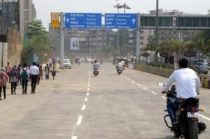
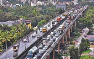
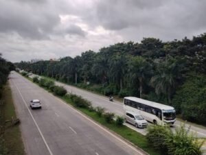
Chamravattom Bridge, officially known as the Chamravattom Regulator-cum-Bridge, is an important road crossing over the Bharathapuzha River in Malappuram district, Kerala. Located near Chamravattom, the bridge creates a direct connection between the Tirur and Ponnani sides of the river and has significantly improved road movement across this part of the district. Kerala’s Irrigation Department lists the bridge at 978 metres long with 70 spans.
Opened in May 2012, Chamravattom Bridge is more than a conventional road structure. It was developed as a multipurpose regulator-cum-bridge, combining vehicular connectivity with plans for water storage, irrigation and other water-management benefits. At the time of inauguration, the new crossing was expected to substantially shorten journeys between Ponnani and Tirur and also provide an alternative corridor for longer Kozhikode–Ernakulam travel.
The regulator component has faced technical problems over the years, particularly water leakage. Major remedial work has therefore remained part of the project’s story, with leak-sealing work reaching another important stage in 2026.
Quick Overview of Chamravattom Bridge
| Particular | Details |
| Official Name | Chamravattom Regulator-cum-Bridge |
| Common Name | Chamravattom Bridge / Chamravattom Palam |
| Location | Malappuram district, Kerala |
| River | Bharathapuzha, also known as Nila |
| Connects | Tirur and Ponnani sides |
| Bridge Length | 978 metres |
| Number of Spans | 70 |
| Roadway Width | Around 7.5 metres in contemporary inauguration reports |
| Structure Type | Road bridge with regulator |
| Opened | May 17, 2012 |
| Major Road Route | Ponnani–Tirur corridor |
| Nearby Areas | Chamravattom, Triprangode, Tirur, Ponnani and BP Angadi |
| Public Transport | KSRTC/private buses, autos, taxis and other road transport |
| Known For | Direct Ponnani–Tirur connection and regulator-cum-bridge design |
Kerala’s Irrigation Department continues to classify Chamravattom as a multipurpose project, while contemporary reports from its opening put the road width at about 7.5 metres.
Where is Chamravattom Bridge Located?
Chamravattom Bridge crosses the Bharathapuzha in Malappuram district, around Chamravattom near Triprangode. The Kerala Irrigation Department places the project within the Tirur and Ponnani taluks.
Its location is important because Ponnani lies on the coastal side of Malappuram district, while Tirur is a major commercial and transport centre farther inland. Before the bridge was constructed, travelling between these areas required a considerably longer road journey using other river crossings.
The bridge now creates a much more direct road connection across Bharathapuzha. It is also useful for motorists travelling between the coastal Ponnani side and destinations around Tirur, Triprangode, BP Angadi and other central parts of Malappuram district.
Chamravattom Bridge Route and Road Connectivity
The bridge forms part of the Ponnani–Tirur road corridor and provides an alternative to longer routes through Kuttippuram and other established highway junctions.
Important connections include:
- Ponnani: Major coastal town and one of the principal destinations served by the bridge.
- Tirur: Important commercial and railway town on the opposite side of the wider corridor.
- Chamravattom: The immediate locality associated with the bridge.
- Triprangode: Nearby locality on the Tirur side of Bharathapuzha.
- BP Angadi: Important road junction on routes towards Tirur and Kuttippuram.
- Kuttippuram: Major NH-66 and railway-connected town offering an alternative Bharathapuzha crossing.
- Malappuram: District headquarters accessible through the wider Tirur road network.
- Kozhikode and Kochi directions: The bridge can form part of alternative regional journeys along the Malabar coast.
When the bridge opened, officials estimated that it would reduce the Ponnani–Tirur road distance by about 20 km and shorten certain Kozhikode–Ernakulam journeys by roughly 35–40 km compared with routes then in regular use.
Why is Chamravattom Bridge Important?
The bridge’s biggest contribution is the direct road connection it created between communities on opposite sides of Bharathapuzha.
It benefits:
- Daily commuters travelling between Tirur and Ponnani
- Students and workers from surrounding villages
- Buses and local passenger vehicles
- Agricultural and commercial traffic
- Visitors travelling towards coastal Malappuram
- Motorists looking for an alternative to more circuitous river-crossing routes
At its inauguration, 28 KSRTC services were reported as operating through the bridge, including routes connecting Kozhikode–Ernakulam, Tirur–Ponnani and Malappuram–Ponnani. This demonstrates how quickly the crossing became part of the region’s public-transport network.
The bridge was also expected to relieve some traffic pressure on towns such as Edappal, Valanchery and Kottakkal by providing another route option for suitable journeys.
Traffic Conditions at Chamravattom Bridge
Chamravattom Bridge does not normally face the same continuous congestion seen on major urban flyovers, but it carries significant regional and local traffic.
Traffic typically includes buses, cars, two-wheelers, local commercial vehicles and people travelling between Ponnani and Tirur. The approaches can be more important to journey time than the central bridge span itself.
Road condition has occasionally affected movement. In January 2025, badly deteriorated approach roads on both sides were taken up for renovation following complaints about potholes and damaged surfaces. Partial traffic restrictions were introduced during the work.
During that renovation, large and goods vehicles approaching from the Tirur side were redirected through BP Angadi and Kuttippuram towards the national highway, while vehicles approaching from Ponnani were also instructed to use alternative highway routes instead of entering the bridge corridor.
These were construction-related diversions rather than permanent restrictions.
Why is it Called a Regulator-cum-Bridge?
Chamravattom is unusual because the project was designed to perform two functions within the same structure.
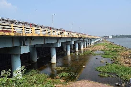
The upper portion carries road traffic across Bharathapuzha, while the regulator beneath the roadway contains gates designed to control river water.
The Kerala Irrigation Department describes the structure as a multipurpose project with 70 spans. Its original objectives went beyond transportation and included water storage and irrigation-related benefits for the Tirur and Ponnani regions.
This makes Chamravattom fundamentally different from a normal bridge such as Kuttippuram Bridge, whose primary role is transportation.
Regulator Leakage and Restoration Work
The water-control side of the project has had a much more difficult history than the road bridge.
Leakage developed in the regulator after the project was completed in 2012, preventing the system from storing water as originally intended. Technical studies and several rounds of remedial work followed.
By January 2026, the latest major leak-sealing work had entered its final stage. The plan reported at that time was to begin storing water from April 1, 2026 after completing the restoration work.
The regulator also remains an active maintenance asset. In August 2026, a Kerala Irrigation Department tender covered replacement of damaged rubber seals, maintenance of vertical gates and hoisting mechanisms, painting and work on sluice shutters at Chamravattom.
These works concern the water-regulation equipment beneath the bridge and should not be confused with ordinary road resurfacing on the bridge deck.
Importance for Bharathapuzha Water Management
The regulator was conceived as more than a barrier across the river.
Its planned water-storage function was intended to support irrigation and improve water availability in surrounding areas. At inauguration, project officials also highlighted potential benefits for drinking water and agriculture in Tirur and Ponnani.
The current Kerala Irrigation Department project profile lists a planned reservoir capacity of 24.49 million cubic metres and a water-spread area of 869 hectares.
The long-running leakage issue meant that achieving these water-management goals proved much more difficult than successfully using the road bridge itself.
That distinction is important: Chamravattom has remained an important transport crossing even while the regulator component required extensive remedial work.
Public Transport Near Chamravattom Bridge
Road-based public transport is the main option around the bridge.
KSRTC and private buses operate through the wider Tirur–Ponnani region, while autos and taxis provide local connections to Chamravattom, Triprangode and neighbouring villages. Bus services began using the bridge immediately after its inauguration.
For railway travel, Tirur Railway Station is the main rail hub on the Tirur side. Kuttippuram also has an important railway station and serves travellers using the NH-66 corridor.
The bridge itself does not carry railway tracks. It is a road crossing integrated with a water regulator.
Major Landmarks and Places Near Chamravattom Bridge
The wider bridge region includes several important religious, transport and natural landmarks:
- Bharathapuzha River: The major river crossed by the bridge and one of Kerala’s best-known rivers.
- Chamravattom Ayyappa Temple: Religious landmark associated with the Chamravattom area.
- Triprangode Siva Temple: Important temple in the wider Tirur region.
- Tirur: Major commercial and railway centre.
- Ponnani: Historic coastal town known for its religious and cultural importance.
- Kuttippuram Bridge: Another major Bharathapuzha crossing farther upstream.
- Tirunavaya: Historic and religious destination on the Bharathapuzha corridor.
The bridge also provides views across the broad Bharathapuzha landscape, particularly outside the monsoon period.
Nearby Areas to Chamravattom Bridge
Chamravattom: The immediate village from which the bridge gets its name.
Triprangode: Nearby locality on the Tirur side and an important part of the bridge’s surrounding road network.
Tirur: Major town with railway, shopping, educational and healthcare facilities.
Ponnani: Important coastal municipality connected more directly with Tirur because of the bridge.
BP Angadi: Road junction useful for travel towards Tirur, Kuttippuram and surrounding areas.
Kuttippuram: Important highway and railway town with another major bridge across Bharathapuzha.
FAQs About Chamravattom Bridge Kerala
Q1. Is Chamravattom Bridge part of NH-66?
No. Chamravattom Bridge primarily serves the Ponnani–Tirur road connection. It provides access to the wider highway network, but the bridge itself should not be confused with the NH-66 crossing at Kuttippuram. Government environmental-clearance documents describe Chamravattom as providing connectivity towards the main highways and the Ponnani–Kozhikode road through Tirur.
Q2. Is Chamravattom Bridge the same as Kuttippuram Bridge?
No. Both cross the Bharathapuzha, but they are separate bridges in different locations. Kuttippuram Bridge forms part of the major highway corridor at Kuttippuram, while Chamravattom provides a more direct road connection between the Ponnani and Tirur sides.
Q3. Does Chamravattom Bridge carry trains?
No. It carries road traffic. The structure beneath the roadway is used for water regulation rather than railway infrastructure.
Q4. Why are gates installed below Chamravattom Bridge?
The gates are part of the regulator system designed to control and store water in Bharathapuzha. This is why the official structure is called a regulator-cum-bridge rather than simply a road bridge.
Q5. Is maintenance still being carried out on the regulator?
Yes. As of August 2026, maintenance procurement covered damaged gate seals, hoisting mechanisms, painting and sluice-shutter work. These works relate mainly to the regulator’s mechanical equipment rather than indicating closure of the road bridge itself.