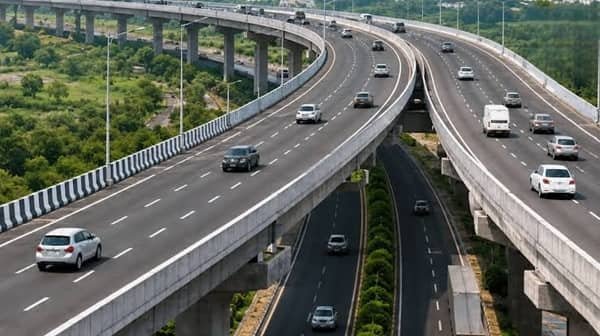
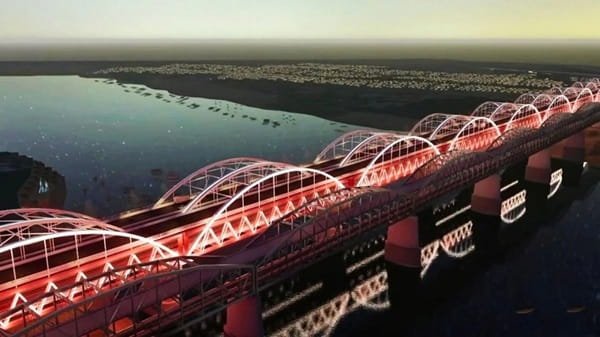
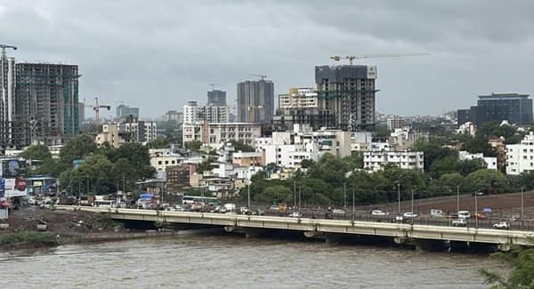
Narmada Bridge in Bharuch generally refers to the New Narmada Bridge, also known as the 3rd Narmada Bridge, an important extradosed road bridge across the Narmada River in Gujarat. Opened to traffic in March 2017, the bridge forms part of the Ahmedabad-Mumbai highway corridor and provides a major crossing between the Bharuch and Ankleshwar sides of the river.
The bridge was developed to reduce the severe congestion that had repeatedly affected older Narmada crossings at Bharuch. It is about 1.34 km long and 20.8 metres wide, with a 14.5-metre carriageway. Its cable-supported design, repeated pylons and illumination have made it one of the most recognisable modern highway bridges in this part of Gujarat.
The name can be confusing because Bharuch has several major crossings over the Narmada. The historic Golden Bridge, Sardar Bridge, the 2017 New Narmada Bridge and a newer eight-lane bridge on the Delhi-Mumbai Expressway are separate structures. This guide focuses specifically on the 2017 NH-48 bridge.
Quick Overview of Narmada Bridge
| Particular | Details |
| Official/Common Name | New Narmada Bridge / 3rd Narmada Bridge |
| Location | Bharuch, Gujarat |
| River | Narmada River |
| Highway | NH-48, formerly NH-8 |
| Bridge Type | Extradosed cable-supported road bridge |
| Length | About 1.34 km |
| Overall Width | About 20.8 metres |
| Carriageway | About 14.5 metres |
| Opened to Traffic | March 2017 |
| Pylons | 9 pylons, about 36 metres high |
| Lighting | More than 400 LED lights |
| Connects | Bharuch side with Ankleshwar side |
| Nearby Areas | Bharuch, Ankleshwar, Zadeshwar, Bholav and Mandva |
| Toll | Part of a tolled NH-48 corridor |
| Known For | Extradosed design and major Ahmedabad-Mumbai highway connectivity |
Official government information records the bridge at about 1.34-1.4 km long, with a 20.8-metre-wide structure, nine pylons and more than 400 LED lights.
Where is Narmada Bridge Located?
Narmada Bridge is located near Bharuch in Gujarat, where NH-48 crosses the Narmada River before continuing towards Ankleshwar and Surat. The bridge forms part of the Ahmedabad-Mumbai section of the national highway and therefore serves both local and long-distance traffic.
Bharuch lies on the northern side of the crossing, while Ankleshwar and its major industrial belt lie to the south. From the Bharuch side, the bridge is accessible through the highway network serving Zadeshwar, Bholav and adjoining neighbourhoods.
Its position on NH-48 gives the bridge considerably more importance than an ordinary city crossing because the route links major economic centres across Gujarat and Maharashtra.
Narmada Bridge Route and Road Connectivity
The bridge lies directly on the major north-south highway corridor through Gujarat.
A typical long-distance route is:
Vadodara → Bharuch → Narmada Bridge → Ankleshwar → Surat → Navsari → Mumbai
Important connections include:
- Bharuch: Main city on the northern bank of the Narmada.
- Ankleshwar: Major industrial city immediately south of the river.
- Zadeshwar: Important Bharuch locality close to the highway approaches.
- Vadodara: Major city north of Bharuch on the same highway corridor.
- Surat: Principal south Gujarat city reached by continuing south on NH-48.
- Dahej: Major industrial and port destination connected through Bharuch district roads.
- Panoli: Important industrial area south of Ankleshwar.
The bridge is therefore important to local residents, industrial workers, freight operators and long-distance travellers using western India’s main highway network.
Why is Narmada Bridge Important?
Before the new bridge opened, traffic at Bharuch was heavily dependent on older Narmada crossings. Maintenance work or restrictions on the Sardar Bridge could result in severe congestion along the Ahmedabad-Mumbai highway.
The 2017 extradosed bridge added another high-capacity crossing and improved the reliability of road travel through Bharuch. Government descriptions of the project specifically highlight its contribution to speed, safety and economic development on this highway corridor.
Its economic importance is also considerable. Bharuch and Ankleshwar are surrounded by major industrial estates, chemical manufacturing facilities, logistics operations and connections towards Dahej. Reliable river crossings are therefore essential not just for passenger movement but also for commercial transport.
Traffic Conditions at Narmada Bridge
Traffic volumes can be high because NH-48 carries private vehicles, buses and substantial commercial traffic. Congestion around the bridge is often influenced by conditions on its approaches and the availability of nearby Narmada crossings.
A recent example occurred in June 2026, when repair work led to the closure of the nearby Sardar Bridge. Traffic was diverted to the cable bridge, creating long queues on both sides of the crossing.
Traffic can become heavier during:
- Peak intercity travel periods
- Industrial shift-change hours
- Holiday traffic
- Maintenance on nearby bridges
- Accidents or lane restrictions on NH-48
- Heavy monsoon conditions
For this reason, travellers should consider traffic across the complete Bharuch-Ankleshwar highway section rather than only the time required to cross the bridge itself.
Engineering and Design of Narmada Bridge
The bridge uses an extradosed design, which combines characteristics of a girder bridge and a cable-stayed structure.
Its deck is supported by cables attached to relatively low pylons. This produces a distinctive cable-supported appearance without requiring the very tall towers normally associated with conventional cable-stayed bridges.
Government information released at its opening described the structure as approximately 1.4 km long and 20.8 metres wide, with a 14.5-metre carriageway. It is supported by nine pylons about 36 metres high and was equipped with more than 400 LED lights.
The bridge was completed in approximately 34 months and entered service in March 2017.
How Narmada Bridge Differs from Other Bharuch Bridges
Bharuch has an unusually large number of significant river crossings, which often causes confusion in online searches.
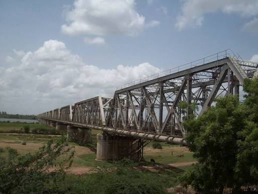
Golden Bridge: This is the historic iron bridge between Bharuch and Ankleshwar. Construction was completed in 1881. It is a completely different structure from the modern cable bridge.
Sardar Bridge: This is another highway crossing over the Narmada and has historically carried major road traffic. Restrictions on this bridge can place additional pressure on the 2017 cable bridge.
Silver Jubilee Railway Bridge: This is primarily a railway bridge between the Bharuch and Ankleshwar railway sections rather than a normal road crossing.
New Narmada Bridge: This is the 2017 extradosed NH-48 bridge covered in this article.
New Eight-Lane Narmada Bridge on Delhi-Mumbai Expressway
Bharuch now also has another major modern Narmada crossing associated with the Delhi-Mumbai Expressway.
In March 2026, the Union government announced completion of India’s first eight-lane extradosed cable-stayed bridge over the Narmada River on the expressway alignment. The new structure is about 2.22 km long.
It is important not to confuse this bridge with the 2017 Narmada Bridge. The 2017 structure belongs to the NH-48 Ahmedabad-Mumbai corridor, while the newer eight-lane bridge belongs to the Delhi-Mumbai Expressway system.
Toll and Highway Use
Narmada Bridge forms part of a tolled national-highway corridor, not a free municipal bridge.
The Indian Highways Management Company Limited’s 2026 national fee-plaza list includes Mandva Toll Plaza (Narmada Bridge) on the Vadodara-Surat section of NH-48 in Bharuch district.
The amount payable depends on factors such as vehicle category, current notified toll rates and applicable FASTag rules. Because these charges can change, travellers should check the current highway toll information before a cost-sensitive journey.
Public Transport Near Narmada Bridge
The bridge itself is a highway crossing rather than a dedicated public-transport interchange.
Road-based travel around the bridge is supported by buses, taxis, autos and private vehicles operating in Bharuch and Ankleshwar.
For railway passengers, Bharuch Junction and Ankleshwar Junction are the main stations on the two sides of the Narmada corridor. Both are recognised stations in Western Railway’s Vadodara division.
Passengers can continue from these railway stations to local destinations by road transport.
Major Landmarks and Facilities Near Narmada Bridge
Important places in the wider bridge area include:
- Narmada River: The major natural feature crossed by the bridge.
- Bharuch city: Historic and commercial centre on the north side.
- Ankleshwar: Major industrial and residential city on the south side.
- Bharuch Junction: Principal railway facility on the Bharuch side.
- Ankleshwar Junction: Important Western Railway station south of the river.
- Golden Bridge: Historic Narmada crossing between Bharuch and Ankleshwar.
- Ankleshwar industrial belt: Major employment and manufacturing zone connected through the wider road corridor.
Nearby Areas to Narmada Bridge
- Bharuch: Main city and district headquarters on the northern side of the river.
- Zadeshwar: Developed Bharuch locality with convenient access towards the NH-48 corridor.
- Bholav: Urban area adjoining Bharuch and its highway connections.
- Ankleshwar: Major industrial and residential centre immediately south of the Narmada.
- Kosamdi: Locality on the Ankleshwar side of the wider highway corridor.
- Panoli: Industrial area farther south along the NH-48 route.
FAQs About Narmada Bridge Bharuch
Q1. Is Narmada Bridge the same as Golden Bridge?
No. Golden Bridge is the historic 1881 crossing. The bridge covered here is the New Narmada Bridge opened in 2017.
Q2. Is the 2026 eight-lane Narmada bridge the same bridge?
No. The newer bridge is a separate 2.22-km Delhi-Mumbai Expressway structure. The bridge covered in this article is the 2017 NH-48 crossing.
Q3. Does Narmada Bridge have a toll?
The wider NH-48 corridor is tolled. IHMCL’s current fee-plaza inventory lists Mandva Toll Plaza (Narmada Bridge) on the Vadodara-Surat section.
Q4. Can pedestrians use Narmada Bridge?
The government’s original bridge description included pedestrian space along the structure. However, it is a busy national-highway crossing, so users should follow any current traffic restrictions or local instructions.
Q5. Which railway stations are useful for the bridge area?
Bharuch Junction serves the Bharuch side and Ankleshwar Junction serves the southern side of the river corridor.
Q6. Why can traffic still build up despite the newer bridge?
The bridge is part of a heavily used highway system and its traffic depends on surrounding approaches and neighbouring crossings. When Sardar Bridge was closed for repairs in June 2026, diverted traffic caused long queues at the cable bridge.