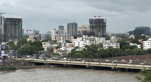
Dahisar Bridge in this guide refers to the Shrikrishna Nagar Bridge over the Dahisar River in Borivali East, Mumbai. The bridge is an important local road link connecting Shrikrishna Nagar, Abhinav Nagar and Shantivan with the Western Express Highway. Because it crosses the Dahisar River and lies close to the northern suburban belt, it is commonly described in local news reports simply as the Dahisar bridge.
The present structure is a reconstructed bridge. A portion of the older crossing collapsed in October 2021, after which the bridge was declared unsafe and closed to vehicles. BMC demolished the old structure and began reconstruction in 2022. The first 11-metre-wide portion, providing two traffic lanes, opened on 11 March 2023.
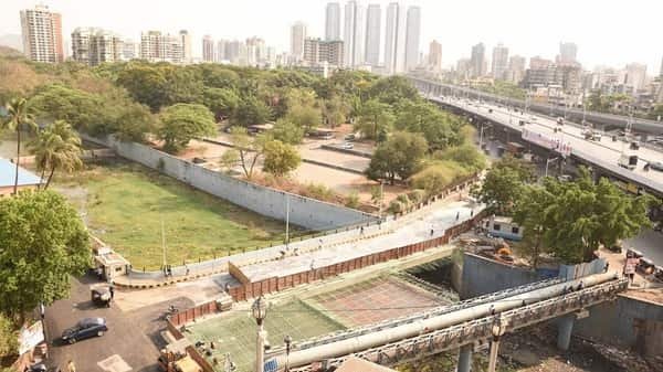
The complete reconstructed bridge was planned at about 41.5 metres long and 22 metres wide. Completion of the remaining half was delayed because part of the approach falls within Sanjay Gandhi National Park forest land. BMC received the required working permission in January 2024. Current reporting from July 2026 confirms that the bridge is in active vehicular use, although the latest clearly documented public lane-status update located in the reviewed sources stated that two of the planned four lanes were operational in January 2024.
Quick Overview of Dahisar Bridge
| Particular | Details |
| Common Name | Dahisar Bridge |
| Local / Project Name | Shrikrishna Nagar Bridge |
| Location | Shrikrishna Nagar, Borivali East, Mumbai |
| Waterbody | Dahisar River |
| Structure Type | Urban vehicular river bridge |
| Planned Total Length | About 41.5 metres |
| Planned Width | About 22 metres |
| Planned Traffic Lanes | Four lanes |
| Phase I Width | About 11 metres |
| Phase I Lanes | Two lanes |
| Phase I Opened | 11 March 2023 |
| Maintaining / Project Authority | Brihanmumbai Municipal Corporation |
| Main Connection | Shrikrishna Nagar, Abhinav Nagar and Shantivan to Western Express Highway |
| Environmental Constraint | Part of the project/approach lies within SGNP forest land |
| Current Use | Active vehicular bridge as of July 2026 |
| Nearby Metro | Magathane Metro Station, Line 7 |
| Nearby Railway Station | Borivali Railway Station |
Where is Dahisar Bridge Located?
The bridge is located at Shrikrishna Nagar in Borivali East, close to the edge of Sanjay Gandhi National Park. It crosses the Dahisar River and links residential areas such as Shrikrishna Nagar, Abhinav Nagar and Shantivan with the Western Express Highway.
Although the bridge is often called Dahisar Bridge because of the river it crosses, its immediate neighbourhood is generally identified as Borivali East. BMC and local news reports also use the name Shrikrishna Nagar Bridge.
The Western Express Highway lies on the western side of the local road connection, while the Shantivan-Abhinav Nagar-Shrikrishna Nagar residential belt extends towards the park-side area.
Dahisar Bridge Route and Road Connectivity
The bridge is mainly a neighbourhood-to-arterial-road connector. It allows residents of the interior Borivali East localities to reach the Western Express Highway without taking a longer diversion through other local roads.
A typical movement is broadly: Shantivan / Abhinav Nagar / Shrikrishna Nagar -> Dahisar Bridge -> Western Express Highway -> Borivali, Dahisar, Kandivali or other Mumbai suburbs.
- Shrikrishna Nagar: Immediate residential locality associated with the bridge.
- Abhinav Nagar: Major residential area directly served by the bridge connection.
- Shantivan: Park-side residential locality using the bridge for highway access.
- Western Express Highway: Main arterial road reached from the bridge.
- Borivali East: Major suburban district surrounding the bridge corridor.
- Dahisar East: Northern suburb accessible through the highway network.
- Kandivali East: Important southbound destination via the Western Express Highway.
Why is Dahisar Bridge Important?
Its importance comes from local connectivity rather than long-distance travel. Shrikrishna Nagar, Abhinav Nagar and Shantivan contain dense residential development, and the bridge provides a direct crossing of the Dahisar River towards the Western Express Highway.
When the old bridge was closed after the 2021 collapse, residents lost this convenient route and had to rely on alternative local roads. The disruption continued for nearly two years before the first reconstructed section opened in March 2023.
The bridge is also useful for access towards Borivali railway station, schools, hospitals, Metro services and the wider commercial areas of Borivali and Dahisar.
Traffic Conditions at Dahisar Bridge
Dahisar Bridge carries local cars, auto-rickshaws, two-wheelers and other neighbourhood traffic feeding into the Western Express Highway. Peak-period pressure is influenced by office-hour travel, school traffic and congestion on the highway approaches.
The first reconstructed portion opened with two lanes in March 2023. In January 2024, BMC-related reporting still described two of the planned four lanes as operational while the remaining work awaited completion after forest clearance.
Current reporting in July 2026 confirms active vehicle movement on the bridge. However, current public sources reviewed do not provide a newer authoritative lane-by-lane operational statement, so the bridge is best described as operational without overstating the status of the complete four-lane widening.
2021 Collapse and Reconstruction
The bridge’s recent history is closely tied to the collapse of the older structure. In October 2021, a portion of the bridge gave way. BMC subsequently declared the crossing dilapidated and unsafe for vehicular use.
A reconstruction tender was issued in January 2022, and demolition and rebuilding followed. The replacement was designed with an integrated deck-slab system. The planned reconstructed bridge measures about 41.5 metres in length and 22 metres in overall width.
Phase I covered an approximately 11-metre-wide section with two traffic lanes. It was inaugurated and opened to motorists on 11 March 2023, restoring at least part of the direct Shrikrishna Nagar-Western Express Highway connection.
Forest Clearance and Why the Project Was Delayed
The second phase could not proceed as quickly as the first because part of the bridge project falls within land associated with Sanjay Gandhi National Park.
BMC officials said about 15 percent of the bridge-related land fell within the forest area. This meant the civic body needed permission from the Forest Department before completing the remaining widened portion.
BMC’s official press-release index records ‘Working permission shree krishna nagar bridge borivali’ and an in-principle forest approval on 11 January 2024. Contemporary reporting said the permission would allow the civic body to restart the remaining work.
The forest issue makes this bridge unusual among Mumbai’s small local crossings: a relatively short neighbourhood bridge required coordination with protected-land authorities because of its position on the edge of Sanjay Gandhi National Park.
Dahisar River Rejuvenation and the Bridge Area
The bridge also sits within a river corridor receiving wider environmental attention. In May 2026, Phase I of the Dahisar River Rejuvenation and Beautification Project was inaugurated.
The broader project targets a 4.75 km stretch of the Dahisar River and includes sewage interception, new sewer lines and sewage-treatment facilities. Phase I included treatment plants at Sukurwadi and Indira Nagar.
The river-rejuvenation scheme is separate from reconstruction of Shrikrishna Nagar Bridge, but it is relevant to the bridge environment because both projects affect the same urban river system. Cleaner water, improved sewage management and better flood management would benefit neighbourhoods along the Dahisar River corridor.
Public Transport Near Dahisar Bridge
The bridge itself is not a public-transport terminal, but the surrounding Borivali East area has good access to buses, autos, suburban rail and Mumbai Metro.
Magathane Metro Station on Mumbai Metro Line 7 is one of the most useful rapid-transit options for Shrikrishna Nagar and nearby Borivali East neighbourhoods. Line 7 is the operational elevated corridor running along the Western Express Highway between Dahisar East and the Andheri/Gundavali side.
Borivali Railway Station is the main suburban railway hub for the wider area. BEST buses and auto-rickshaws connect the interior residential localities with the railway station, Metro stations and the Western Express Highway.
Major Landmarks and Facilities Near Dahisar Bridge
- Sanjay Gandhi National Park: Protected green area beside the wider Shrikrishna Nagar-Shantivan belt.
- Western Express Highway: Mumbai’s major north-south arterial road near the bridge.
- Magathane Metro Station: Operational Line 7 station serving the Borivali East area.
- Borivali Railway Station: Major Western Railway suburban station.
- Abhinav Nagar: Established residential locality close to the bridge.
- Shantivan: Residential area on the SGNP side of the bridge corridor.
- Dahisar River: Urban river crossed by the bridge.
Nearby Areas to Dahisar Bridge
- Shrikrishna Nagar: The immediate locality from which the project’s formal local name is derived.
- Abhinav Nagar: Dense residential neighbourhood directly linked to the bridge.
- Shantivan: Residential pocket close to Sanjay Gandhi National Park.
- Magathane: Borivali East locality with Metro Line 7 access.
- Borivali East: Major suburban residential and commercial district.
- Dahisar East: Northern Mumbai suburb connected through the Western Express Highway.
- Kandivali East: Large neighbouring suburb south of Borivali.
FAQs About Dahisar Bridge Mumbai
Q. Why is it called Dahisar Bridge when it is in Borivali East?
The structure crosses the Dahisar River, so local news reports often call it the Dahisar bridge. BMC-related reporting more specifically identifies it as the Shrikrishna Nagar Bridge in Borivali East.
Q. Is Dahisar Bridge fully open in 2026?
Current July 2026 reporting confirms that vehicles are using the bridge. The latest clearly documented lane-status update in the reviewed public sources stated that two of the planned four lanes were operational in January 2024, so it is safer not to claim a newer four-lane status without a current BMC confirmation.
Q. Is this the same bridge as the proposed River Valley Road bridge in Dahisar West?
No. BMC separately proposed a 50-metre bridge across the Dahisar River connecting River Valley Road with Rangnath Keskar Road in Dahisar West. That is a different project.
Q. Is there a toll on Dahisar Bridge?
No. It is a local BMC road bridge and does not operate as a tolled crossing.
Q. Why did reconstruction take longer than expected?
The first half opened in 2023, but completion of the remaining widened portion required Forest Department permission because part of the project affects land associated with Sanjay Gandhi National Park.
Q. Which Metro station is useful for Shrikrishna Nagar and the bridge area?
Magathane Metro Station on Line 7 is a practical rapid-transit option for the Shrikrishna Nagar-Borivali East area.
Q. Does Dahisar Bridge cross railway tracks?
No. This bridge crosses the Dahisar River. It should not be confused with railway overbridges or foot overbridges around Dahisar railway station.